Reference Year: 2024 • Source: U.S. Census Bureau • Last Checked: October 2026 • Submit Correction
Kane County, Utah
Authoritative civic guide, municipal directory, geographic facts, and information checked business resources across Kane County.
Executive Geographic & Civic Profile
Kanab
8,825
3,990 sq mi
3,180 – 9,600 ft (Sunset Cliffs / Markagunt Plateau)
1864
Southwestern Utah & Color Country
Geographic Boundaries: Bounded by Garfield County (Bryce Canyon high rim, Paunsaugunt Plateau) to the north, Coconino and Mohave Counties, Arizona (37th parallel north / Arizona Strip) to the south, San Juan County (Colorado River / Lake Powell / Glen Canyon) to the east, and Washington and Iron Counties (Zion National Park high country, Markagunt Plateau) to the west. Stretches from the Navajo sandstone canyons and Vermilion Cliffs along the Arizona border northward across the White Cliffs and Pink Cliffs of the Grand Staircase, encompassing the upper reaches of Lake Powell westward to the eastern plateau gate of Zion National Park.
According to official census demographic data (2024 U.S. Census Bureau Estimate), Kane County supports an established resident population of 8,825. Regional planning prioritizes balanced commercial growth, open-space preservation, natural resource stewardship, and active civic infrastructure.
Geography, Elevation & Regional Climate
Kane County encompasses diverse Western topography ranging across elevations of 3,180 – 9,600 ft (Sunset Cliffs / Markagunt Plateau). The regional climate is characteristically semi-arid with four distinct seasons, featuring low relative humidity, abundant sunshine, and cold winters with snow accumulations concentrated across mountain watersheds and high plateaus. Annual precipitation supports native desert shrublands, pinyon-juniper woodlands, sagebrush steppe, and subalpine forests that define the regional geography.
Information Checked Directory in Kane County
Information Checked Directory & Public Services
Featured commercial enterprises physically operating in Kane County across core economic sectors, providing checked local services.
Sego Restaurant
Restaurants & Food
Celebrated contemporary regional restaurant in Kanab serving innovative American craft cuisine, social small plates, artisan cocktails, and locally sourced seasonal ingredients.
Kanab Creek Bakery
Restaurants & Food
European-style artisan bakery and cafe in Kanab baking handcrafted sourdough loaves, French pastries, espresso drinks, and wood-fired breakfast and lunch fare.
Kane County Hospital
Healthcare & Wellness
25-bed critical access community hospital in Kanab providing 24/7 Level 4 emergency medical care, general surgical procedures, diagnostic imaging, physical therapy, and cardiac rehabilitation.
State Bank of Southern Utah – Kanab
Financial Services
Full-service community bank branch on Center Street in Kanab offering commercial lending, agricultural credit, personal banking, and mortgage financing across Kane County.
Search Kane County Business Directory
Direct access to local contractors, medical clinics, retail establishments, and professional services across Kane County.
Municipalities & Communities in Kane County
Explore incorporated municipal governments, civic centers, and regional hubs within Kane County.
Authentic Landscapes & Historic Architecture
Verified documentary photography showcasing public conservation areas, historic facilities, and scenic viewpoints in Kane County.

Resident Information & Municipal Services
Verified public administration, emergency management, school districts, and essential public utilities serving Kane County residents.
County Administration
- Kane County Commission (Three elected full-time commissioners)
- Kane County Assessor’s Office (Property valuation and assessment rolls)
- Kane County Clerk / Auditor (Elections, corporate licensing records, budget management)
- Kane County Recorder’s Office (Deeds, land titles, subdivision plats, mining claims)
- Kane County Treasurer’s Office (Tax collection and fiscal management)
- Kane County Attorney’s Office (Prosecution and civil counsel)
- Kane County Land Use, Building & GIS Department
- Southwest Utah Public Health Department (Kanab Clinic Branch)
Public Safety & Emergency
- Kane County Sheriff’s Office (Patrol, corrections, 24/7 dispatch, mountain and slot canyon search and rescue)
- Kanab City Police Department (Municipal law enforcement and traffic safety)
- Kanab Fire Department (Structural fire protection, hazmat, emergency medical services)
- Orderville Volunteer Fire Department
- Glendale Volunteer Fire Department
- Big Water Volunteer Fire Department
- Cedar Mountain Fire Protection District (Duck Creek Village and alpine resort communities)
Healthcare Resources
- Kane County Hospital (Kanab – 25-bed critical access hospital, 24/7 Level 4 Trauma Emergency Department, surgical suite, acute care, cardiac rehabilitation, physical therapy)
- Valley Clinic in Orderville (Family practice and outpatient medical care for Long Valley)
- Red Sands Clinic and Kanab Family Medicine
Education & Libraries
- Kane County School District (Kanab High School, Valley High School in Orderville, middle and elementary schools; serving approx. 1,450 students)
- Southwest Technical College (Kanab outreach educational center offering career technical certificates and continuing education)
- Dixie State / Utah Tech University Kanab Education Center (Distance learning and concurrent enrollment)
- Kanab City Library (Downtown community resource center, public computers, children’s reading programs)
- Valley Community Library in Orderville (Serving northern Kane County and Long Valley residents)
Transportation Arterials & Public Transit
- U.S. Highway 89 (Major national highway running north-south through Kanab and Long Valley connecting to Flagstaff and Salt Lake City)
- Utah State Route 9 (Zion-Mount Carmel Highway connecting Mount Carmel Junction west through the historic Zion Tunnel into Zion Canyon)
- Utah State Route 14 (Cedar Mountain Scenic Byway ascending from Long Valley west through Duck Creek Village to Cedar City)
- Utah State Route 89A (Connecting Kanab south across the Arizona Strip toward Jacob Lake and the Grand Canyon North Rim)
- Cottonwood Canyon Road (Scenic unpaved BLM backcountry route connecting US-89 to Cannonville through Grand Staircase-Escalante)
- Kanab Municipal Airport (KNB – General aviation, scenic air tours, emergency medical air transport, 6,200-ft paved runway)
- Southern Utah Scenic Shuttles (Private regional transit linking Kanab to St. George and Las Vegas airport shuttles)
- Kane County Senior Center Transportation Services
Parks, Public Lands & Outdoor Recreation
Federal conservation lands, state parks, and regional recreation areas throughout Kane County.
Federal Public Lands (NPS, BLM, USFS)
- Grand Staircase-Escalante National Monument (BLM – Headquarters in Kanab, Paria Contact Station, Big Water Visitor Center; White Cliffs, Vermilion Cliffs, Buckskin Gulch, Paria Canyon-Vermilion Cliffs Wilderness permit area)
- Zion National Park – East Entrance (NPS – Checkerboard Mesa, East Rim Trail, slickrock formations on UT-9)
- Bryce Canyon National Park – Southern Rim (NPS – Paunsaugunt Plateau high rim viewpoints)
- Glen Canyon National Recreation Area (NPS – Wahweap shoreline, Lone Rock Beach, Lake Powell access near Big Water)
- Dixie National Forest – Cedar City Ranger District (USFS – Duck Creek Village, Navajo Lake, Aspen-Mirror Lake, Markagunt Plateau high timber)
- BLM Kanab Field Office (Rangelands, Mansard petroglyph trail, Red Canyon, Coral Pink sand corridors)
State Parks & Regional Attractions
- Coral Pink Sand Dunes State Park (Utah State Park featuring shifting pink sand dunes, nature trails, and designated off-highway vehicle riding areas)
- Jacob Hamblin Park and Kanab City Parks (Community sports fields, splash pad, tennis courts, and walking loops)
- Best Friends Animal Sanctuary Canyon Memorials (Angel Canyon parklands and trails)
- The Wave / Coyote Buttes North (World-famous jurassic sandstone formation on the BLM Utah/Arizona border administered via Kanab permit lottery)
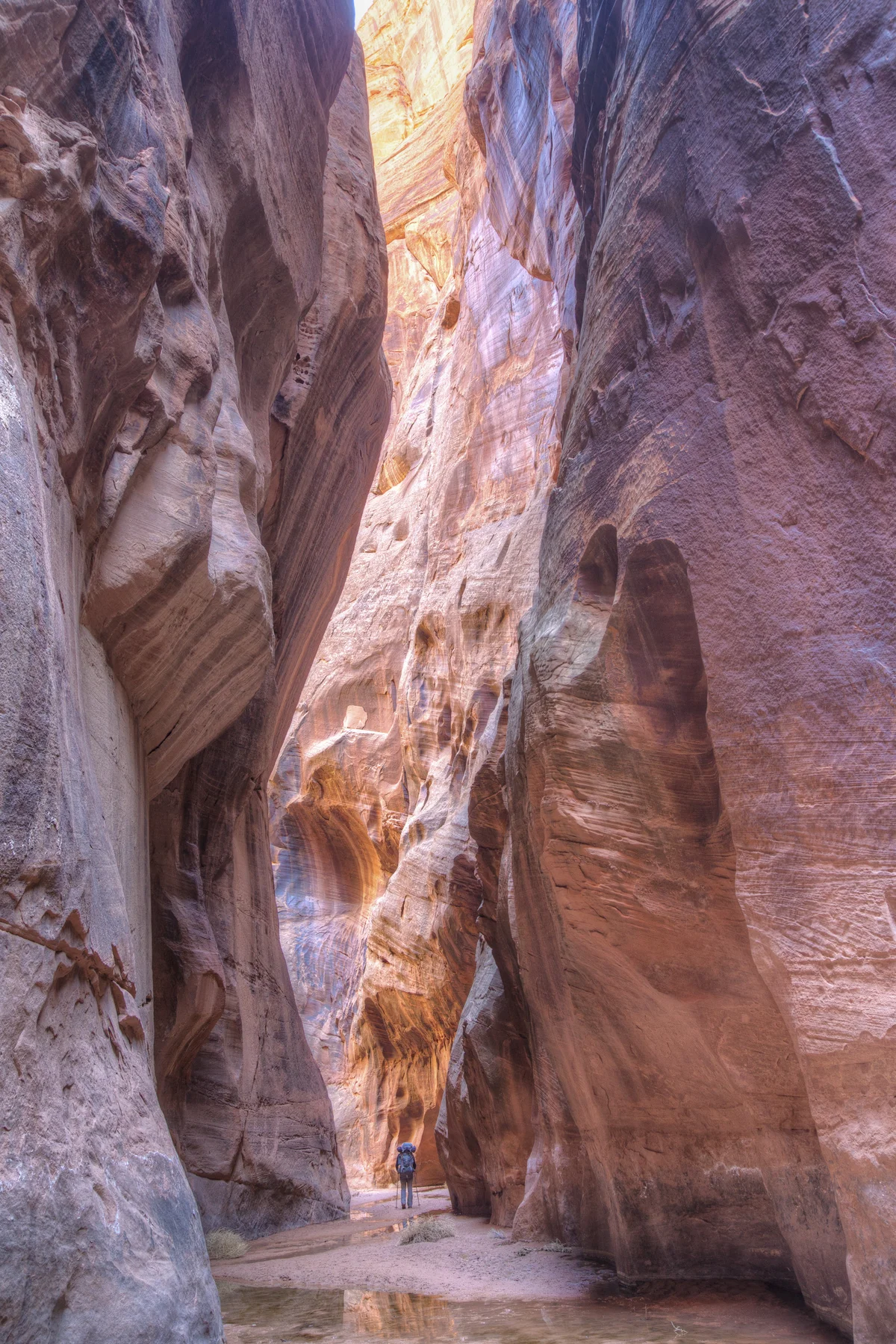
- Buckskin Gulch (Longest and deepest continuous slot canyon in the United States, major backcountry day hike)
- Best Friends Animal Sanctuary (Nation’s largest companion animal sanctuary, located in scenic Angel Canyon north of Kanab)
- Little Hollywood Movie Museum (Preserved historic western film sets constructed in Kanab for classic Hollywood cinema and television)
- Belly of the Dragon (Man-made drainage tunnel through sandstone near Mount Carmel Junction, popular family trail)
Economic Landscape, Industry Sectors & Commercial Permitting
Kane County maintains an established economic base founded upon diverse commercial, agricultural, and industrial pillars. Commercial development operates under coordinated municipal-county guidelines: businesses within incorporated municipalities obtain commercial business licenses through their municipal clerk, while enterprises in unincorporated county areas are permitted directly through the Kane County administrative offices.
- Tourism & Hospitality (National park gateways to Zion, Bryce, Grand Canyon North Rim, lodging, outfitters, food service)
- Animal Welfare & Non-Profit Administration (Best Friends Animal Society headquarters, global volunteer programs)
- Public Land Management & Forestry (BLM Monument Headquarters, National Park Service, U.S. Forest Service)
- Healthcare & Senior Living (Kane County Hospital, physical therapy, assisted living facilities)
- Agriculture & Livestock (Beef cattle ranching, alfalfa hay in Long Valley and Glendale)
All legal commercial entities operating in Utah must register their organizational charter with the Utah Division of Corporations and Commercial Code and maintain appropriate sales tax accounts with the Utah State Tax Commission. Consumers are encouraged to verify professional contractor, medical, and trade licensing directly through the Utah Division of Professional Licensing (dopl.utah.gov).
Annual Civic Events & Cultural Traditions
Signature annual festivals, county fairs, rodeos, and community celebrations held across Kane County.
- Western Legends Heritage Roundup (August celebration of cowboy poetry, western films, chuckwagons, and western music in Kanab)
- Balloons & Tunes Roundup (February hot air balloon festival launching against the red sandstone cliffs of Kanab)
- Kane County Fair (August agricultural exhibits, rodeo, and junior livestock sale in Orderville)
- Greyhounds in Sedona and Kanab Gathering
- Kanab 4th of July Celebration and Grand Fireworks Display
Regional Guides & Utah Travel Resources
Deepen your exploration of Kane County with regional itineraries, moving guides, and scenic driving routes.
Explore community profiles, civic directories, and local business ecosystems across Utah.
Statewide travel itineraries, public lands access, national monuments, and regional highways.
How local businesses can claim profiles and establish claimed profile status on Greater Utah.
Adjacent Counties & Regional Travel
Explore neighboring counties connected across Utah:
Promote Your Kane County Enterprise
Connect with residents, commercial buyers, and traveling visitors actively seeking trusted local services and products in Kane County.
📷 Image Provenance & Photography Attribution
✓ Real Location Verified
GreaterUtah strictly enforces an Image Authenticity & Media Provenance Policy. All documentary imagery depicts authentic Utah locations and is verified via staff photography, federal public-domain repositories, or verified Creative Commons records. AI-generated, synthetic, and deceptive imagery are strictly prohibited.
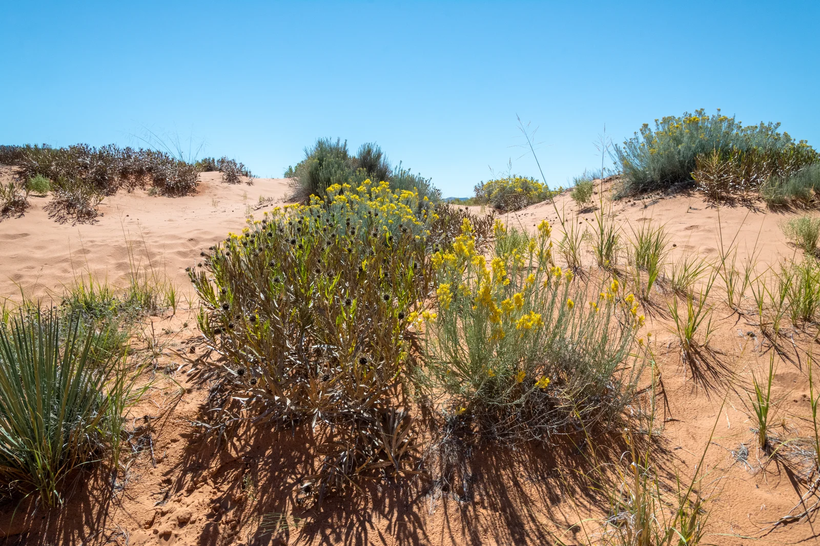
Coral Pink Sand Dunes State Park rolling sand dunes framed by Moquith Mountains in Kane County • Photo: dconvertini • License: CC BY-SA 2.0
Editorial Methodology: All facts in this guide are independently corroborated through official public records, municipal licensing files, state agency datasets, and federal land management records. Demographics reflect 2024 U.S. Census Bureau Estimate (Reference Year: 2024; Source: U.S. Census Bureau; Last Checked: October 2026).
Data Citations: State of Utah (Utah.gov), U.S. Census Bureau, Utah Division of Corporations, National Park Service, Bureau of Land Management, U.S. Forest Service, and Kane County administrative records.