Reference Year: 2024 • Source: U.S. Census Bureau • Last Checked: October 2026 • Submit Correction
Utah County, Utah
Authoritative civic guide, municipal directory, geographic facts, and information checked business resources across Utah County.

Executive Geographic & Civic Profile
Provo
706,836
2,003 sq mi
4,488 – 11,928 ft (Mount Nebo)
1852
Wasatch Front
Geographic Boundaries: Bounded by Salt Lake County (Traverse Mountains) to the north, Sanpete County and Juab County to the south, Wasatch County to the east, and Tooele County to the west. Centered around Utah Lake and bounded by the Wasatch Range to the east (Mount Timpanogos and Mount Nebo) and West Mountain, Cedar Valley, and the Goshen Valley to the west.
According to official census demographic data (2024 U.S. Census Bureau Estimate), Utah County supports an established resident population of 706,836. Regional planning prioritizes balanced commercial growth, open-space preservation, water resource protection, and active transportation connectivity.
Geography, Elevation & Regional Climate
Utah County encompasses diverse Western topography ranging across elevations of 4,488 – 11,928 ft (Mount Nebo). The regional climate is characteristically semi-arid with four distinct seasons, featuring low relative humidity, warm sunny summers, and cold winters with snow accumulations concentrated across mountain watersheds. Annual precipitation supports native high-desert shrublands, sagebrush valleys, and alpine forest ecosystems that define the region’s scenic character.
Information Checked Directory in Utah County
Information Checked Directory & Public Services
Featured commercial enterprises physically operating in Utah County across core economic sectors.
Communal Restaurant
Restaurants & Food
Downtown Provo farm-to-table dining establishment prioritizing regional Utah agricultural growers and seasonal menus.
Asado Argentine Grill
Restaurants & Food
Traditional South American wood-fired steakhouse serving authentic empanadas, grilled meats, and chimichurri specialties.
Davies Allen, P.C. CPAs
Professional Services
Certified public accounting and corporate advisory firm serving commercial enterprises throughout Silicon Slopes.
Lehi Animal Hospital
Pets & Veterinary
Comprehensive small-animal veterinary clinic providing wellness exams, surgical care, and diagnostic medicine in northern Utah County.
Search Utah County Business Directory
Direct access to local contractors, medical clinics, retail establishments, and professional services across Utah County.
Municipalities & Communities in Utah County
Explore incorporated municipal governments, civic centers, and regional hubs within Utah County.
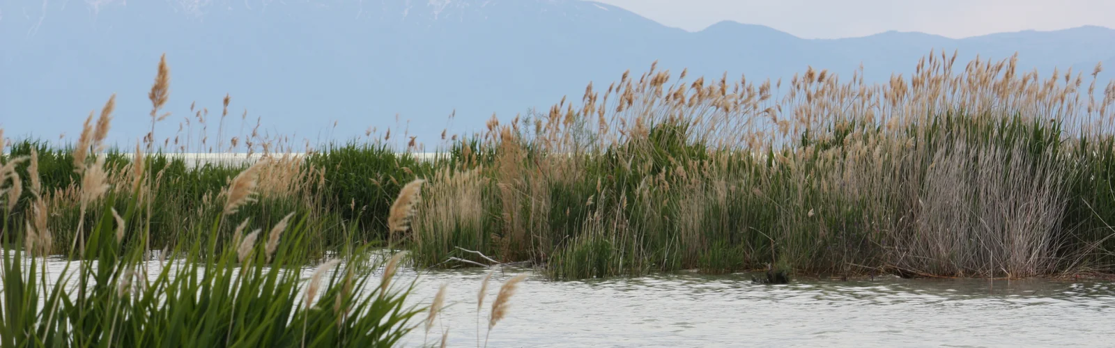
Authentic Landscapes & Historic Architecture
Verified documentary photography showcasing public conservation areas, historic facilities, and scenic viewpoints in Utah County.

Resident Information & Municipal Services
Verified public administration, emergency management, school districts, and essential public utilities serving Utah County.
County Administration
- Utah County Commission (3 full-time commissioners)
- County Clerk’s Office
- Auditor’s Office
- Assessor’s Office
- Recorder’s Office
- Treasurer’s Office
- Surveyor’s Office
- County Attorney’s Office
- Utah County Health Department
- Community Development Department
Public Safety & Emergency
- Utah County Sheriff’s Office (Spanish Fork HQ)
- Provo Police Department
- Orem Police Department
- Lehi Police Department
- Spanish Fork Police Department
- Lone Peak Public Safety District (Highland/Alpine)
- Utah County Fire Department & Wildland Fire Division
Healthcare Resources
- Utah Valley Hospital (Provo, Intermountain Healthcare, Level 2 Trauma Center)
- Timpanogos Regional Hospital (Orem, MountainStar Healthcare)
- Primary Children’s Hospital Miller Family Campus (Lehi, Intermountain)
- Mountain View Hospital (Payson, MountainStar Healthcare)
- Revere Health Clinics (Multi-specialty network headquartered in Provo)
Education & Libraries
- Alpine School District (Largest district in Utah, approx. 85,000 students)
- Nebo School District (South Utah County, approx. 35,000 students)
- Provo City School District (Provo municipal boundaries, approx. 14,000 students)
- Brigham Young University (BYU, 34,000+ students)
- Utah Valley University (UVU, 41,000+ students, largest public university in Utah)
- Mountainland Technical College (MTECH, campuses in Lehi, Orem, Spanish Fork)
- Provo City Library at Academy Square
- Orem Public Library
- Lehi Public Library
- Springville Public Library
- Spanish Fork Library
- American Fork Library
- Pleasant Grove Library
- Payson City Library
Transportation Arterials & Public Transit
- Interstate 15 (Primary freeway corridor connecting north and south Utah County)
- US Highway 6 (Spanish Fork Canyon route connecting to Price and eastern Utah)
- US Highway 89 (Historic State Street corridor and canyon connector)
- US Highway 189 (Provo Canyon Scenic Byway to Heber Valley)
- Utah State Route 92 (Timpanogos Highway through Lehi and Highland)
- Utah State Route 68 (Redwood Road along west shore of Utah Lake)
- Utah State Route 73 (Cedar Fort and Eagle Mountain arterial)
- UTA FrontRunner Commuter Rail (Stations in Lehi, American Fork, Vineyard, Orem, Provo)
- Utah Valley Express (UVX) Bus Rapid Transit (Fare-free BRT connecting UVU, BYU, and Provo station)
- UTA local bus routes across Utah Valley
- Provo Airport (PVU – Commercial passenger flights via Allegiant Air, Breeze Airways, American Airlines)
Parks, Public Lands & Outdoor Recreation
National forests, state parks, and protected recreational watersheds throughout Utah County.
Federal & State Conservation Lands
- Uinta-Wasatch-Cache National Forest (Pleasant Grove and Spanish Fork Ranger Districts)
- Mount Timpanogos Wilderness Area
- Lone Peak Wilderness Area
- Nebo Loop National Scenic Byway and Mount Nebo Wilderness
- BLM public lands in Lake Mountain and Cedar Valley
Regional Parks & Signature Attractions
- Utah Lake State Park (Marina, boating, fishing, sunsets)
- Bridal Veil Falls Park (Provo Canyon double cataract waterfall)
- Thanksgiving Point Ashton Gardens (55 acres of manicured botanical displays)
- Spanish Oaks Reservoir and Canyon (Recreation, fishing, disc golf)
- Canyon Glen Park and Vivian Park (Provo Canyon)
- Thanksgiving Point (Museum of Natural Curiosity, Butterfly Biosphere, Museum of Ancient Life, Farm Country)
- Timpanogos Cave National Monument (NPS guided cave tours in American Fork Canyon)
- Sundance Mountain Resort (Skiing, summer theater, art studio founded by Robert Redford)
- Springville Museum of Art (Utah’s oldest museum for visual arts, Spanish Colonial architecture)
- BYU Museum of Art & Monte L. Bean Life Science Museum
- Camp Floyd State Park (Fairfield historic military post)
Economic Landscape, Industry Sectors & Commercial Permitting
Utah County maintains a resilient economic base founded upon diverse commercial and industrial pillars. Enterprise development operates under municipal-county coordination: enterprises within incorporated city boundaries obtain local commercial licenses through their municipal clerk, while businesses in unincorporated areas are licensed directly through the Utah County administrative division.
- Information Technology and Software (‘Silicon Slopes’ in Lehi/Draper)
- Higher Education (BYU, UVU, MTECH)
- Advanced Manufacturing, Medical Devices, and Aerospace
- Healthcare and Biotechnology
- Commercial and Residential Construction
- Agriculture and Orchards (Southern Utah County: Payson, Santaquin fruitway)
All legal commercial entities operating in Utah must register their organizational charter with the Utah Division of Corporations and Commercial Code and maintain appropriate sales tax accounts with the Utah State Tax Commission. Consumers are encouraged to verify professional contractor, medical, and trade licensing directly through the Utah Division of Professional Licensing (dopl.utah.gov).
Annual Civic Events & Cultural Traditions
Signature annual festivals, agricultural exhibitions, and community celebrations held across Utah County.
- America’s Freedom Festival at Provo & Stadium of Fire (July 4th week)
- Utah County Fair (Spanish Fork Fairgrounds in August)
- Spanish Fork Fiesta Days (July PRCA Rodeo)
- Springville Art City Days (June)
- American Fork Steel Days (July)
- Timpanogos Storytelling Festival
Regional Guides & Utah Travel Resources
Deepen your exploration of Utah County with regional itineraries, moving guides, and scenic driving routes.
Silicon Slopes tech corridor relocation and housing overview.
Historic Cedar Valley rural outpost and historic landmarks.
Comprehensive directory of community guides across Utah.
Alpine Loop, Nebo Loop, and mountain highway routes.
Adjacent Counties & Regional Travel
Explore neighboring counties connected across Utah:
Promote Your Utah County Enterprise
Connect with residents, local commercial buyers, and traveling visitors actively seeking trusted local services and products in Utah County.
Editorial Methodology: All facts in this guide are independently corroborated through official public records, municipal licensing files, and state datasets. Demographics reflect 2024 U.S. Census Bureau Estimate (Reference Year: 2024; Source: U.S. Census Bureau; Last Checked: October 2026).
Data Citations: State of Utah (Utah.gov), U.S. Census Bureau, Utah Division of Corporations, and local municipal administrative records.