Independent Civic, Commercial & Geographic Information
Operating Record Checked • Sep 2026
Wayne County, Utah
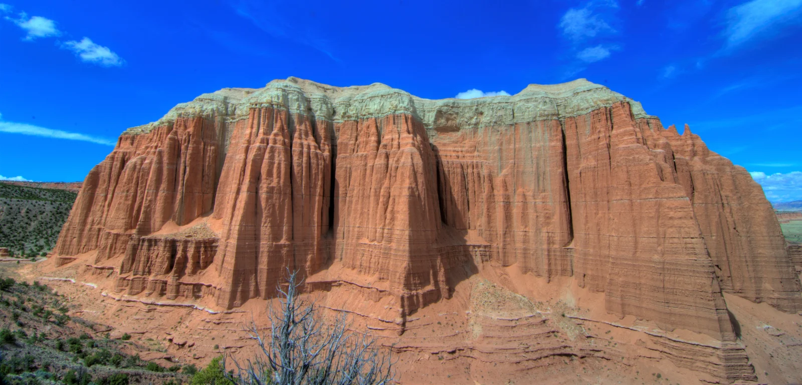
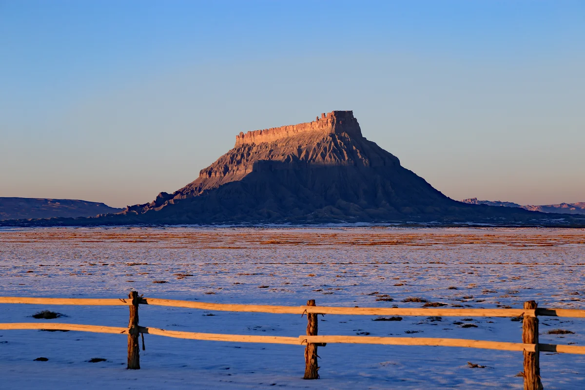
Stretching across south-central Utah from the subalpine aspen forests and high trout lakes of Boulder and Thousand Lake Mountains in the west, descending through the green agricultural valley of the Fremont River and the 100-mile Waterpocket Fold of Capitol Reef National Park, to the stark desert badlands of Factory Butte and the Henry Mountains in the east.
Wayne County Overview
-
County Seat:
Loa (County Seat & Agricultural Center) -
Population:
2,600 (2024 U.S. Census Bureau Estimate) -
Land Area:
2,466 sq mi -
Elevation Range:
4,100 – 11,306 ft (Thousand Lake Mountain / Bluebell Knoll) -
Established:
1892 -
Official Portal:
waynecounty.utah.gov →
Highlighted: Wayne County within Utah’s 29-county network
Towns & Communities in Wayne County
Wayne County comprises independent incorporated municipalities and historic rural settlements, each serving as an agricultural, civic, commercial, or outdoor recreation center for the surrounding region.
Loa
Pop. ~600
Administrative county seat located at 7,060 feet in upper Rabbit Valley, featuring the historic red sandstone courthouse, State Bank of Southern Utah, and commercial services for local cattle ranching families.
Bicknell
Pop. ~350
Central community of Rabbit Valley, home to Wayne High School, Wayne Middle School, the Wayne Community Health Center, and the historic Bicknell International Film Festival.
Torrey
Pop. ~300
Picturesque tree-lined gateway town situated 8 miles west of Capitol Reef National Park along Scenic Byway UT-24, known for dark sky conservation, boutique lodges, guide outfitters, and fine dining.
Hanksville
Pop. ~250
Strategic southeastern desert crossroads at the junction of UT-24 and UT-95, serving travelers exploring the Henry Mountains, Goblin Valley, Lake Powell, and the remote dirty devil canyonlands.
Fruita & Teasdale
Pop. ~200
Fruita is the preserved pioneer orchard oasis within Capitol Reef National Park; Teasdale is a scenic agricultural village tucked beneath the red sandstone ledges of Boulder Mountain.
Rural Healthcare Access & Regional Service Centers
Because Wayne County maintains a low-density rural population, essential local community healthcare is paired with established regional medical centers in neighboring counties for advanced surgical, inpatient trauma, and intensive specialty services.
Wayne Community Health Center (128 S 300 W, Bicknell; federally qualified health clinic providing primary medical consultations, dental services, mental healthcare, and clinical pharmacy).
Full inpatient hospitalization, Level 4 emergency trauma surgery, and advanced diagnostic care are accessed regionally in Richfield (Sevier Valley Hospital, 50 miles northwest in Sevier County via UT-24 and UT-119). Emergency aeromedical helicopter evacuation operates from Bicknell and Hanksville airstrips for life-threatening traumas.
Local grocery shopping and supplies are provided by Royal’s Market in Loa and The Chuckwagon General Store & Deli in Torrey. Fuel plazas operate in Loa, Bicknell, Torrey, and Hanksville along Highway 24.
Local farm and automotive service centers operate in Loa and Bicknell. Specialized heavy machinery parts and building supply centers are accessed in Sevier County.
Richfield (Sevier County) serves as the primary regional retail, hospital, and commercial trade center for Wayne County residents. Green River (Emery County) provides regional eastern highway connectivity via I-70.
Information Checked Directory in Wayne County
Independent, information checked businesses serving residents and travelers in Wayne County.
Operating Record Checked • Sep 2026
Wayne Community Health Center
Federally qualified community health center in Bicknell providing comprehensive primary medical care, dental services, behavioral health, pharmacy, and urgent illness treatment across rural Wayne County.
Operating Record Checked • Sep 2026
The Rim Rock Restaurant
Western steakhouse and panoramic dining room overlooking the red rock cliffs of Capitol Reef National Park along Highway 24, serving hand-cut steaks, fresh trout, pastas, and craft beers.
Operating Record Checked • Sep 2026
Capitol Reef Resort
58-acre upscale resort property located 1 mile from Capitol Reef National Park, featuring guest rooms, luxury cabins, Conestoga glamping wagons, teepees, horseback excursions, and an outdoor heated pool.
Operating Record Checked • Sep 2026
State Bank of Southern Utah – Loa
The central commercial and agricultural financial hub in the county seat of Loa, offering deposit accounts, ranch financing, residential mortgages, and commercial lines of credit.
Operating Record Checked • Sep 2026
Hondoo Rivers & Trails
Established licensed wilderness outfitter operating since 1975 from Torrey, specializing in multi-day horseback trail rides, interpretive hiking tours, and backcountry camping trips across Capitol Reef country.
Operating Record Checked • Sep 2026
Torrey Trading Post
Authentic Southwest trading post and gallery in Torrey featuring handmade Native American turquoise jewelry, Navajo rugs, Zuni carvings, local Utah artisan crafts, and regional books.
Operating Record Checked • Sep 2026
Hunt’s Trading Post & Cafe
Vital desert crossroads restaurant and traveler trading post in Hanksville on UT-24, serving fresh burgers, thick milkshakes, homestyle sandwiches, road supplies, and rock hound specimens.
Search Wayne County Local Directory
Locate checked dining, retail, professional services, contractor trades, and healthcare resources across Wayne County.
Authentic Landscapes & Historic Architecture

Resident Information & Municipal Services
- Wayne County Commission (County executive and legislative body)
- Wayne County Clerk, Auditor & Recorder
- Wayne County Assessor & Treasurer
- Wayne County Economic Development & Travel Council
- Wayne County Justice Court
- Wayne County Sheriff’s Office (Headquartered in Loa)
- Wayne County Backcountry Search & Rescue (Desert and mountain technical units)
- Wayne County Volunteer Fire Departments (Loa, Bicknell, Torrey, Teasdale, Hanksville)
- Wayne County Emergency Medical Services (Volunteer paramedic ambulance crews)
- Wayne County School District (Serving entire county)
- Wayne High School & Wayne Middle School (Bicknell)
- Loa Elementary (Loa) & Hanksville Elementary (Hanksville)
- Wayne County Public Library (Bicknell Branch)
- Hanksville Community Library (Hanksville Branch)
- Snow College Richfield Campus (Primary regional higher education, 50 miles northwest)
- Utah State University Extension (Wayne County Office in Loa)
Geography, Elevation & Regional Climate
Wayne County encompasses diverse topography ranging across elevations of 4,100 – 11,306 ft (Thousand Lake Mountain / Bluebell Knoll). The regional climate is characteristically semi-arid with four distinct seasons, featuring low relative humidity, abundant sunshine, and cold winters with snow accumulations concentrated across mountain watersheds and high plateaus. Annual precipitation supports native desert shrublands, pinyon-juniper woodlands, sagebrush steppe, and subalpine forests that define the regional geography.
- UT-24 (Primary arterial through Rabbit Valley, Capitol Reef, and Hanksville)
- UT-12 Scenic Byway (All-American Road ascending Boulder Mountain)
- UT-95 (Trail of the Ancients corridor south toward San Juan County)
Parks, Public Lands & Outdoor Recreation
Public federal and state lands encompass a substantial portion of Wayne County, supporting protected natural attractions, wilderness trail systems, and seasonal outdoor sporting.
- Capitol Reef National Park (100-mile Waterpocket Fold, Hickman Bridge, Fruita)
- Goblin Valley State Park (Adjacent northern border, accessed via Hanksville)
- Torrey Town Parks & Loa Town Square
- Fishlake National Forest & Dixie National Forest (Thousand Lake and Boulder Mountains)
- Bureau of Land Management (Cathedral Valley, Factory Butte, San Rafael Desert)
- Henry Mountains Public Lands (Free-roaming wild bison herd)
Commercial Permitting & Business Licensing
Commercial business operations in Wayne County are regulated through municipal business licensing within incorporated cities and through the Wayne County Commission and Planning Department for unincorporated county areas. State registration with the Utah Division of Corporations and professional licensing through the Utah Department of Commerce are required for active commercial standing.
- Tourism & Hospitality (National park lodging, dining, outfitting, guiding)
- Agriculture & Cattle Ranching (High-altitude cow-calf operations, hay farming)
- Public Land Administration (National Park Service, Forest Service, BLM)
- Artisan Craft & Specialty Food Production
- County Planning & Zoning: Contact Wayne County Administrative Offices
- Incorporated Municipalities: Contact local City or Town Hall
- State Entity Registration: Utah Division of Corporations →
- Professional Licenses: Utah DOPL Portal →
Signature Annual Events & Festivals
- Wayne County Fair (Held annually in August at Loa fairgrounds)
- Torrey Apple Days & 4th of July Celebration (Torrey)
- Bicknell International Film Festival (Annual cultural cinema weekend)
- Hanksville Fall Heritage Days (October in Hanksville)
Regional Guides & Exploration Resources
Directory of comprehensive municipal and regional guides across Utah.
Exploration resources covering scenic highways, mountain recreation, and public lands.
Guide for business owners on verification, directory listings, and local search.
Explore Bordering Utah Counties
Continue your regional exploration across neighboring counties in Utah’s 29-county network: