Reference Year: 2024 • Source: U.S. Census Bureau • Last Checked: October 2026 • Submit Correction
Emery County, Utah
Authoritative civic guide, municipal directory, geographic facts, and information checked business resources across Emery County.

Executive Geographic & Civic Profile
Castle Dale
10,082
4,462 sq mi
4,000 – 10,743 ft (East Mountain / Wasatch Plateau)
1880
Castle Country & San Rafael Swell
Geographic Boundaries: Bounded by Carbon County (Book Cliffs, Price River drainage) to the north, Wayne County (San Rafael Desert, Muddy Creek, Goblin Valley) to the south, Grand County (Green River, Labyrinth Canyon) to the east, and Sanpete and Sevier Counties (Wasatch Plateau crest / Skyline Drive) to the west. Stretches from the alpine aspen and conifer forests of the Wasatch Plateau eastward across the irrigated farming communities of Castle Valley and the rugged, deeply incised sandstone canyons of the 2,000-square-mile San Rafael Swell to the Green River on the eastern county border.
According to official census demographic data (2024 U.S. Census Bureau Estimate), Emery County supports an established resident population of 10,082. Regional planning prioritizes balanced commercial growth, open-space preservation, natural resource stewardship, and active civic infrastructure.
Geography, Elevation & Regional Climate
Emery County encompasses diverse Western topography ranging across elevations of 4,000 – 10,743 ft (East Mountain / Wasatch Plateau). The regional climate is characteristically semi-arid with four distinct seasons, featuring low relative humidity, abundant sunshine, and cold winters with snow accumulations concentrated across mountain watersheds and high plateaus. Annual precipitation supports native desert shrublands, pinyon-juniper woodlands, sagebrush steppe, and subalpine forests that define the regional geography.
Information Checked Directory in Emery County
Information Checked Directory & Public Services
Featured commercial enterprises physically operating in Emery County across core economic sectors, providing checked local services.
Emery Medical Center
Healthcare & Wellness
Comprehensive outpatient community health clinic in Castle Dale affiliated with Castleview Hospital, providing primary family medicine, minor trauma stabilization, diagnostic imaging, and laboratory testing.
Ray’s Tavern
Restaurants & Food
Legendary river runners’ gathering hall and tavern in Green River operating since 1943, famous for thick half-pound hamburgers, wood-charred pork chops, and cold regional microbrews.
Eastern Utah Community Credit Union – Castle Dale
Financial Services
Member-owned financial cooperative branch on Main Street in Castle Dale providing auto loans, home mortgages, agricultural credit, and personal checking for Castle Country residents.
Castle Valley Outdoors
Recreation & Outfitting
Leading Orvis-endorsed wingshooting lodge and outdoor recreation resort on Main Street in Emery, providing guided upland bird hunts, clay shooting, luxury lodge accommodations, and gourmet dining.
Search Emery County Business Directory
Direct access to local contractors, medical clinics, retail establishments, and professional services across Emery County.
Municipalities & Communities in Emery County
Explore incorporated municipal governments, civic centers, and regional hubs within Emery County.
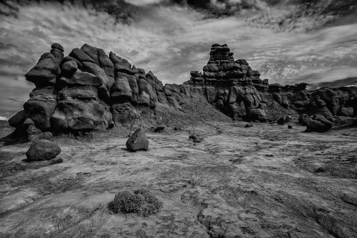
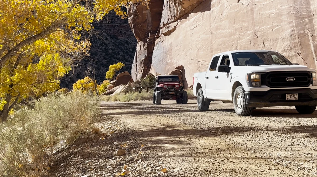
Authentic Landscapes & Historic Architecture
Verified documentary photography showcasing public conservation areas, historic facilities, and scenic viewpoints in Emery County.
Resident Information & Municipal Services
Verified public administration, emergency management, school districts, and essential public utilities serving Emery County residents.
County Administration
- Emery County Commission (Three elected commissioners)
- Emery County Assessor’s Office (Property valuation and assessment rolls)
- Emery County Clerk / Auditor (Elections, county records, budget administration)
- Emery County Recorder’s Office (Deeds, land surveys, mining claims)
- Emery County Treasurer (Tax billing, collections, and treasury accounting)
- Emery County Attorney’s Office (Civil representation and criminal prosecution)
- Emery County Public Lands, Zoning & Building Department
- Southeastern Utah Health Department (Castle Dale Clinic Branch)
Public Safety & Emergency
- Emery County Sheriff’s Office (Patrol, county jail in Castle Dale, dispatch, backcountry search and rescue)
- Castle Dale Fire Department
- Huntington Volunteer Fire Department
- Ferron Volunteer Fire Department
- Orangeville Volunteer Fire Department
- Green River Volunteer Fire Department
- Cleveland / Elmo Volunteer Fire Department
- Emery Town Volunteer Fire Department
Healthcare Resources
- Emery Medical Center in Castle Dale (Comprehensive primary care, urgent care, laboratory, imaging, affiliated with Castleview Hospital)
- Green River Medical Center (Federally Qualified Community Health Center providing essential medical and emergency care along remote I-70)
- Wayne Community Health Center Clinic outreach
Education & Libraries
- Emery County School District (Emery High School in Castle Dale, Green River High School, San Rafael Middle School, Canyon View Middle School; approx. 2,100 students)
- Utah State University Eastern – Castle Dale Education Center (Concurrent enrollment, technical trade certificates, and distance learning courses)
- Emery County Library System – Castle Dale Branch (County headquarters and regional research collection)
- Huntington Public Library
- Ferron Public Library
- Orangeville Public Library
- Green River Public Library
- Cleveland Public Library
- Emery Town Library
Transportation Arterials & Public Transit
- Interstate 70 (Major national transcontinental interstate traversing 106 service-free miles across the San Rafael Swell from Green River to Salina)
- Utah State Route 10 (Primary north-south Castle Valley highway linking Price through Huntington, Castle Dale, and Ferron to I-70)
- Utah State Route 31 (Huntington Canyon National Scenic Byway ascending from Huntington into the Wasatch Plateau toward Fairview)
- Utah State Route 29 (Connecting Orangeville west to Joes Valley Reservoir and across the Skyline Drive)
- U.S. Highway 191 (Connecting Green River north to Price and south toward Moab)
- Green River Amtrak Station (Daily California Zephyr passenger rail service connecting Chicago to San Francisco via Salt Lake City and Denver)
- Huntington Municipal Airport (69V – General aviation, 4,000-ft paved runway)
- Green River Municipal Airport (U34 – General aviation serving eastern Emery County)
- Emery County Senior Transportation Services
Parks, Public Lands & Outdoor Recreation
Federal conservation lands, state parks, and regional recreation areas throughout Emery County.
Federal Public Lands (NPS, BLM, USFS)
- San Rafael Swell Recreation Area (BLM – Congressionally protected 216,000-acre public recreation complex including 14 wilderness areas: Muddy Creek, Mexican Mountain, Crack Canyon; The Wedge Overlook / ‘Little Grand Canyon’, Buckhorn Wash rock art)
- Manti-La Sal National Forest – Ferron-Price Ranger District (USFS – Joes Valley Reservoir bouldering, Skyline Drive, Huntington Canyon scenic byway, Stuart Guard Station)
- Jurassic National Monument / Cleveland-Lloyd Dinosaur Quarry (BLM – World’s densest concentration of Allosaurus and Jurassic dinosaur bones)
- Labyrinth Canyon Wilderness (BLM – Scenic flatwater river canyon corridor on the Green River)
- BLM Price Field Office (Managing public desert lands across the San Rafael Swell)
State Parks & Regional Attractions
- Goblin Valley State Park (Utah State Park near Hanksville/Green River featuring thousands of bizarre mushroom-shaped sandstone hoodoos and dark sky stargazing)
- Millsite State Park in Ferron (Reservoir boating, sandy beaches, trophy trout fishing, adjacent to Millsite Golf Course)
- Huntington State Park (Warm-water reservoir watersports, boating, fishing, and birdwatching)
- Green River State Park (Riverside camping, 9-hole golf course, major launch point for multi-day float trips down Labyrinth Canyon)
- Museum of the San Rafael in Castle Dale (Exhibits featuring dinosaur skeletons, Fremont culture artifacts, pioneer history)
- The Wedge Overlook / ‘Little Grand Canyon’ (1,200-foot vertical viewpoint over the San Rafael River canyon in northern San Rafael Swell)
- Joes Valley Sandstone Bouldering (Internationally recognized bouldering destination attracting international climbers to classic sandstone boulders in straight canyon and left fork)
- Buckhorn Draw Rock Art Panel (Massive Barrier Canyon style prehistoric pictograph mural painted on sandstone canyon walls)
- San Rafael Swinging Bridge (Utah’s oldest suspension bridge, built by the Civilian Conservation Corps in 1937 over the San Rafael River)
- John Wesley Powell River History Museum in Green River (Exhibits detailing historical river exploration of the Green and Colorado rivers)
Economic Landscape, Industry Sectors & Commercial Permitting
Emery County maintains an established economic base founded upon diverse commercial, agricultural, and industrial pillars. Commercial development operates under coordinated municipal-county guidelines: businesses within incorporated municipalities obtain commercial business licenses through their municipal clerk, while enterprises in unincorporated county areas are permitted directly through the Emery County administrative offices.
- Energy Generation & Power Infrastructure (PacifiCorp Huntington Power Plant, Hunter Power Plant in Castle Dale, solar arrays)
- Coal Mining & Resource Extraction (Underground coal mining supplying regional power generation, industrial gravel and gypsum)
- Agriculture & Alfalfa Hay (Irrigated beef cattle ranching, dairy feed, Green River commercial melon production)
- Public Land Recreation & Adventure Tourism (San Rafael Swell motorized recreation, Joes Valley bouldering, Goblin Valley visitors)
- Public Education & County Administration (Emery County School District, county and municipal civic government)
All legal commercial entities operating in Utah must register their organizational charter with the Utah Division of Corporations and Commercial Code and maintain appropriate sales tax accounts with the Utah State Tax Commission. Consumers are encouraged to verify professional contractor, medical, and trade licensing directly through the Utah Division of Professional Licensing (dopl.utah.gov).
Annual Civic Events & Cultural Traditions
Signature annual festivals, county fairs, rodeos, and community celebrations held across Emery County.
- Emery County Fair (July agricultural celebration, concert, demolition derby, and rodeo in Castle Dale)
- Green River Melon Days (September festival celebrated since 1906 with world-famous cantaloupe and watermelon carving, parade, and car show)
- Joes Valley Bouldering Fest (September gathering of hundreds of rock climbers for clinics, competitions, and community service in Orangeville)
- San Rafael Swell OHV Trail Rides and Spring ATV Rallies
- Castle Dale 4th of July Celebration and Fireworks
Regional Guides & Utah Travel Resources
Deepen your exploration of Emery County with regional itineraries, moving guides, and scenic driving routes.
Explore community profiles, civic directories, and local business ecosystems across Utah.
Statewide travel itineraries, public lands access, national monuments, and regional highways.
How local businesses can claim profiles and establish claimed profile status on Greater Utah.
Adjacent Counties & Regional Travel
Explore neighboring counties connected across Utah:
Promote Your Emery County Enterprise
Connect with residents, commercial buyers, and traveling visitors actively seeking trusted local services and products in Emery County.
📷 Image Provenance & Photography Attribution
✓ Real Location Verified
GreaterUtah strictly enforces an Image Authenticity & Media Provenance Policy. All documentary imagery depicts authentic Utah locations and is verified via staff photography, federal public-domain repositories, or verified Creative Commons records. AI-generated, synthetic, and deceptive imagery are strictly prohibited.
The Wedge Overlook Little Grand Canyon of the San Rafael River in Emery County • Photo: Andrey Zharkikh • License: CC BY 2.0
Editorial Methodology: All facts in this guide are independently corroborated through official public records, municipal licensing files, state agency datasets, and federal land management records. Demographics reflect 2024 U.S. Census Bureau Estimate (Reference Year: 2024; Source: U.S. Census Bureau; Last Checked: October 2026).
Data Citations: State of Utah (Utah.gov), U.S. Census Bureau, Utah Division of Corporations, National Park Service, Bureau of Land Management, U.S. Forest Service, and Emery County administrative records.