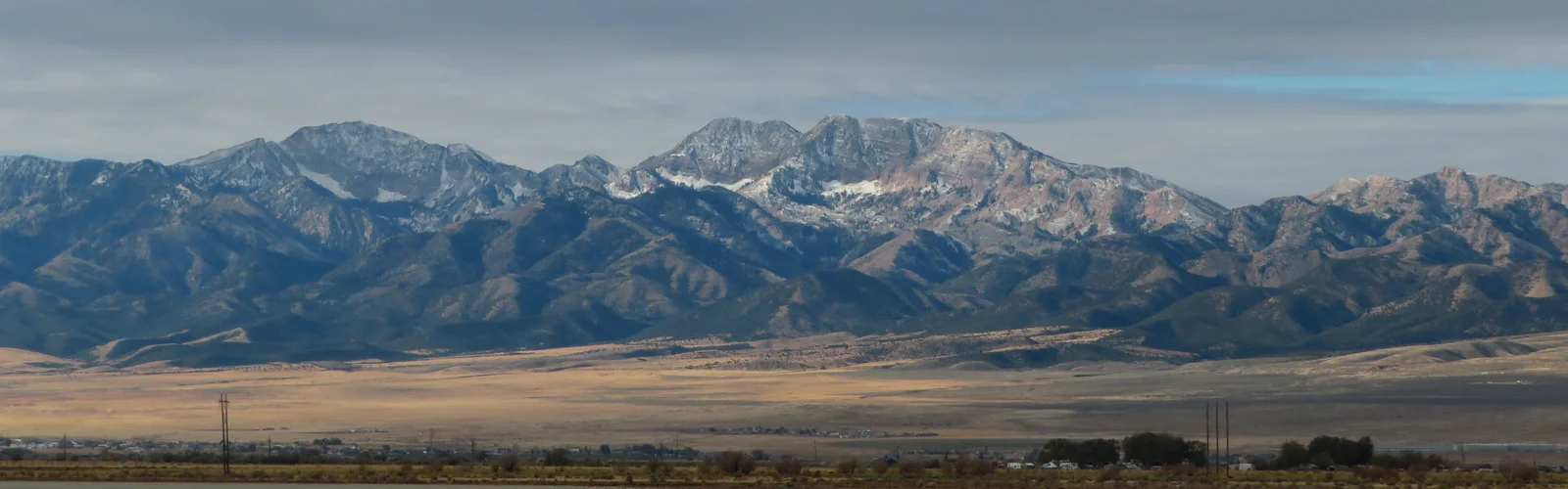
Deseret Peak Quick Facts
11,031 Feet
Stansbury Mountains, Tooele County
Deseret Peak Wilderness (25,000+ Acres)
U.S. Forest Service (Wasatch-Cache)
Loop Trailhead (South Willow Canyon)
Late June – Mid-October
Wilderness Landscape & Natural Setting
Rising abruptly from the Great Basin Desert to an elevation of 11,031 feet, Deseret Peak is the crowning summit of the Stansbury Mountain Range. Designated by Congress in 1990, the Deseret Peak Wilderness preserves more than 25,000 acres of rugged limestone cliffs, glaciated cirques, spring-fed aspen groves, and high alpine ridges just 45 miles west of Salt Lake City.
Because the Stansbury Range stands isolated between Skull Valley to the west and the Tooele Valley to the east, it functions as an ecological “sky island.” Deep canyons such as South Willow Canyon channel cool mountain runoff, supporting lush Douglas fir, Engelmann spruce, and vibrant wildflowers that contrast sharply with the arid salt flats below. Wildlife commonly observed in the wilderness includes mule deer, mountain lions, chukar, golden eagles, and occasional bighorn sheep on the high rocky ledges.
Summit Hiking Trails & Backcountry Routes
The premier trail in the range is the Deseret Peak Loop Trail, a world-class 7.5-mile alpine loop that climbs approximately 3,600 feet from the end of the South Willow Canyon Road. Hikers typically ascend via the Mill Fork trail through shaded fir forests before breaking out into alpine cirques and traversing the high ridge to the summit. From the top, panoramic views extend across the Great Salt Lake, the Wasatch Front, and the expansive Bonneville Salt Flats toward Nevada.
Other notable routes include the Medina Flat trail, providing equestrian and backpacking access toward the southern wilderness boundary, and the North Willow Canyon route for rugged, unmaintained backcountry exploration.
Deseret Peak Trail & Hiking Guide
Check trailhead coordinates, turn-by-turn waypoint descriptions, elevation profiles, and essential packing checklists.
Camping Facilities & Wilderness Stewardship
Camping within South Willow Canyon offers a serene mountain getaway beneath towering limestone walls. The U.S. Forest Service maintains several small, rustic developed campgrounds along South Willow Canyon Road, including Lower Narrows, Upper Narrows, Intake, Boy Scout, and Loop Campgrounds. Sites are available on a first-come, first-served basis, equipped with fire rings, picnic tables, and vault toilets (potable water is seasonal; carrying your own drinking water is strongly advised).
Leave No Trace & Wilderness Rules: Mechanized equipment (including bicycles, drones, chainsaws, and ATVs) is strictly prohibited inside the designated wilderness boundary. Dispersed backcountry camping is permitted throughout the wilderness, provided campsites are located at least 200 feet from streams, springs, and trails. All trash must be packed out, and campfires must strictly adhere to current regional Forest Service fire restrictions.
The Deseret Peak Complex (Tooele County Multi-Use Venue)
In addition to the natural wilderness peak, the name “Deseret Peak” is shared by the premier sports, motorsports, and event facility in western Utah: the Deseret Peak Complex. Located along Highway 112 between Grantsville and Tooele, this 140-acre multi-purpose county recreation complex hosts regional equestrian events, motocross competitions, demolition derbies, archery tournaments, and community fairs.
Key amenities at the complex include an outdoor aquatic center, regulation baseball and softball fields, indoor and outdoor equestrian arenas, a BMX track, and convention facilities. If you are traveling to Tooele County for scheduled sports tournaments or county events, the complex provides convenient parking and family recreational facilities minutes from Grantsville lodging and dining.
💡 Local Summit Tip: Watch Summer Afternoon Weather
During July and August, monsoonal thunderstorms regularly build over the Stansbury Range by early afternoon. Because the final two miles of the Deseret Peak trail follow an exposed ridgeline above 10,000 feet, begin your ascent early in the morning (by 6:30 or 7:00 AM) and aim to descend from the summit ridge before noon to avoid lightning hazards.
Gateway Communities, Supplies & Dining
Because there are no commercial businesses or fueling stations inside the wilderness area, outdoor visitors base their trips out of neighboring Tooele County communities. Explore our local city guides to plan your meals, lodging, and gear:
Closest gateway for gas, convenience stores, post-hike dining, and access to Grantsville Reservoir.
County seat offering hotels, major grocery and outdoor gear suppliers, and full medical facilities.
Community lake recreation, local dining options, and public stargazing at the Stansbury Observatory.
Emergency, Ranger District & Forest Contacts
- Wilderness Management: U.S. Forest Service – Salt Lake Ranger District | Phone: (801) 733-2660
- Deseret Peak Complex Office: 2930 UT-112, Grantsville, UT 84029 | Phone: (435) 843-4000
- Emergency / Search & Rescue: Tooele County Sheriff’s Office & Search and Rescue | Call 911 (Non-Emergency: 435-882-5600)
- Hospital / Emergency Care: Mountain West Medical Center (Tooele) | 2055 N Main St, Tooele, UT
Outfitter, Guide, or Business Serving Tooele County Outdoor Visitors?
Connect your outdoor recreation services, guided tours, lodging, or local gear shop with active Utah hikers, campers, and destination travelers.
All Greater Utah guides are subject to independent editorial review. Found trail or facility updates? Submit a correction request.
GreaterUtah.com is an independent Utah directory and outdoor destination guide. We are not officially affiliated with the U.S. Forest Service, Tooele County government, or the Deseret Peak Complex.
© 2026 Greater Utah Guide. All Rights Reserved.