Reference Year: 2024 • Source: U.S. Census Bureau • Last Checked: October 2026 • Submit Correction
Garfield County, Utah
Authoritative civic guide, municipal directory, geographic facts, and information checked business resources across Garfield County.
Executive Geographic & Civic Profile
Panguitch
5,248
5,175 sq mi
3,700 – 11,328 ft (Mount Ellen, Henry Mountains)
1882
Southwestern Utah & Color Country / Escalante Canyons
Geographic Boundaries: Bounded by Wayne and Piute Counties (Aquarius Plateau, Boulder Mountain, Capitol Reef) to the north, Kane County (Paunsaugunt Plateau rim, Grand Staircase) to the south, San Juan County (Colorado River / Cataract Canyon / Lake Powell) to the east, and Iron and Beaver Counties (Markagunt Plateau high rim) to the west. Spans over 5,100 square miles of extraordinarily rugged terrain across south-central Utah—from the historic brick agricultural communities along the Sevier River on US-89 eastward across Bryce Canyon, Grand Staircase-Escalante, and Boulder Mountain along All-American Road UT-12 to the wild Henry Mountains and Lake Powell at Bullfrog Basin.
According to official census demographic data (2024 U.S. Census Bureau Estimate), Garfield County supports an established resident population of 5,248. Regional planning prioritizes balanced commercial growth, open-space preservation, natural resource stewardship, and active civic infrastructure.
Geography, Elevation & Regional Climate
Garfield County encompasses diverse Western topography ranging across elevations of 3,700 – 11,328 ft (Mount Ellen, Henry Mountains). The regional climate is characteristically semi-arid with four distinct seasons, featuring low relative humidity, abundant sunshine, and cold winters with snow accumulations concentrated across mountain watersheds and high plateaus. Annual precipitation supports native desert shrublands, pinyon-juniper woodlands, sagebrush steppe, and subalpine forests that define the regional geography.
Information Checked Directory in Garfield County
Information Checked Directory & Public Services
Featured commercial enterprises physically operating in Garfield County across core economic sectors, providing checked local services.
Garfield Memorial Hospital
Healthcare & Wellness
Intermountain Health 14-bed critical access community hospital in Panguitch providing 24/7 Level 4 emergency trauma services, general surgery, diagnostic imaging, and long-term care for Garfield County.
Hell’s Backbone Grill and Farm
Restaurants & Food
Nationally acclaimed farm-to-table restaurant in Boulder along Scenic Byway 12, serving organic regional Four Corners cuisine made with heirloom produce from their own 6-acre organic farm.
Cowboy’s Smokehouse Cafe
Restaurants & Food
Western barbecue restaurant on historic Main Street in Panguitch smoking beef brisket, pulled pork, and pork ribs over local hardwood, alongside classic homestyle sides and homemade pies.
Escalante Outfitters
Recreation & Outfitting
Independent backcountry gear shop, guide service, artisan pizza cafe, and log cabin lodge on Main Street in Escalante outfitting hikers, backpackers, and canyon explorers.
Search Garfield County Business Directory
Direct access to local contractors, medical clinics, retail establishments, and professional services across Garfield County.
Municipalities & Communities in Garfield County
Explore incorporated municipal governments, civic centers, and regional hubs within Garfield County.
Authentic Landscapes & Historic Architecture
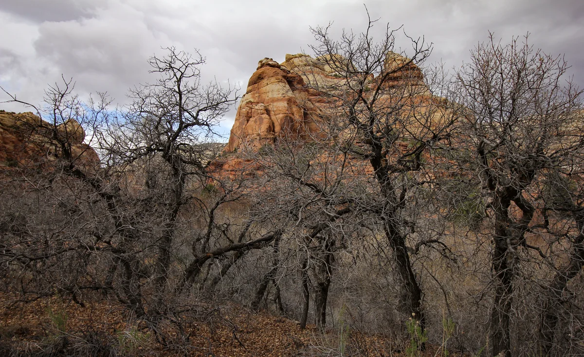
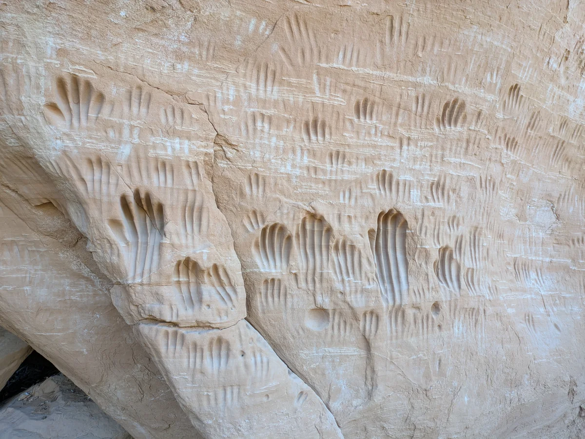
Verified documentary photography showcasing public conservation areas, historic facilities, and scenic viewpoints in Garfield County.
Resident Information & Municipal Services
Verified public administration, emergency management, school districts, and essential public utilities serving Garfield County residents.
County Administration
- Garfield County Commission (Three elected commissioners)
- Garfield County Assessor’s Office (Property valuation and assessment rolls)
- Garfield County Clerk / Auditor (Elections, county records, fiscal administration)
- Garfield County Recorder’s Office (Deeds, land titles, historical survey plats)
- Garfield County Treasurer (Tax collection and treasury distribution)
- Garfield County Attorney’s Office (Civil legal counsel and prosecution)
- Garfield County Planning, Building & Economic Development
- Southwest Utah Public Health Department (Panguitch Clinic Branch)
Public Safety & Emergency
- Garfield County Sheriff’s Office (Patrol, county jail facility, backcountry search and rescue)
- Panguitch Volunteer Fire Department
- Escalante Volunteer Fire Department
- Tropic Volunteer Fire Department
- Boulder Volunteer Fire Department
- Antimony Volunteer Fire Department
- Cannonville Volunteer Fire Department
- Utah Highway Patrol (Section 11 coverage along US-89 and UT-12)
Healthcare Resources
- Garfield Memorial Hospital (Panguitch – Intermountain Health 14-bed critical access hospital, 24/7 Level 4 Trauma Emergency Department, surgical suite, imaging, physical therapy, affiliated nursing home)
- Panguitch Medical Clinic & Specialty Clinic
- Kazan Memorial Clinic in Escalante (Comprehensive rural community medical clinic)
- Bryce Valley Clinic in Tropic
Education & Libraries
- Garfield County School District (Panguitch High School, Bryce Valley High School in Tropic, Escalante High School; serving approx. 950 students across expansive rural distances)
- Southwest Technical College (Panguitch and Escalante technical skills outreach)
- Southern Utah University & Utah State University Distance Learning Centers
- Garfield County Library System – Panguitch Branch (Historic county library and research center)
- Garfield County Library – Escalante Branch
- Garfield County Library – Tropic Branch
- Garfield County Library – Boulder Branch
- Garfield County Library – Henrieville Branch
Transportation Arterials & Public Transit
- Scenic Byway 12 / All-American Road (Utah State Route 12 – 122-mile statewide recognized highway climbing over Boulder Mountain at 9,600 ft, traversing The Hogback, and connecting Panguitch through Escalante to Torrey)
- U.S. Highway 89 (Major north-south highway through western Garfield County connecting Panguitch and Hatch)
- Utah State Route 63 (Entrance road into Bryce Canyon National Park from UT-12)
- Utah State Route 143 (Patchwork Parkway National Scenic Byway connecting Panguitch to Panguitch Lake and Brian Head)
- Utah State Route 276 (Access highway to Bullfrog Marina on Lake Powell in eastern Garfield County)
- Burr Trail Road (Scenic partially paved backcountry route linking Boulder across Capitol Reef Waterpocket Fold to Bullfrog)
- Panguitch Municipal Airport (U55 – General aviation, emergency medical air transport, 5,700-ft runway)
- Bryce Canyon Airport (BCE – Historic national park log-cabin airport, charter flights, air ambulance)
- Bryce Canyon National Park Shuttle System (Seasonal park transit connecting Bryce Canyon City hotels to park amphitheater viewpoints)
- Garfield County Senior Citizen Bus Services
Parks, Public Lands & Outdoor Recreation
Federal conservation lands, state parks, and regional recreation areas throughout Garfield County.
Federal Public Lands (NPS, BLM, USFS)
- Bryce Canyon National Park (NPS – World’s largest concentration of natural rock hoodoos, Bryce Amphitheater, Sunset Point, Inspiration Point, Fairyland Loop)
- Grand Staircase-Escalante National Monument (BLM – Escalante Interagency Visitor Center, Cannonville Visitor Center; Calf Creek Falls, Hole-in-the-Rock Road, Peek-a-boo and Spooky slot canyons)
- Dixie National Forest – Powell & Escalante Ranger Districts (USFS – Boulder Mountain high plateau, Red Canyon sandstone tunnels, Panguitch Lake, Blue Spruce)
- Capitol Reef National Park – Southern Waterpocket Fold (NPS – Burr Trail Switchbacks, Muley Twist Canyon, Halls Creek Narrows)
- Glen Canyon National Recreation Area – Bullfrog Marina (NPS – Houseboat rentals, public boat launches, ferry connection to Halls Crossing across Lake Powell)
- Henry Mountains Public Lands (BLM – Mount Ellen, one of the last free-roaming genetically pure wild American bison herds in North America)
State Parks & Regional Attractions
- Kodachrome Basin State Park near Cannonville (Utah State Park featuring 67 multicolored sedimentary sand pipes, hiking trails, camping)
- Escalante Petrified Forest State Park (Wide Hollow Reservoir water recreation, fossilized wood nature trail in Escalante)
- Anasazi State Park Museum in Boulder (Prehistoric Ancestral Puebloan village ruins occupied from A.D. 1050 to 1200, interpretive museum)
- Panguitch Triple C Arena (Major regional indoor rodeo and equestrian event facility)
- Lower Calf Creek Falls (Iconic 126-foot perennial waterfall cascading over mineral-stained sandstone in Grand Staircase-Escalante)
- Panguitch Lake (Popular high-elevation rainbow trout fishing, ice fishing, and summer alpine recreation on Markagunt Plateau)
- The Hogback on Scenic Byway 12 (Knife-edge ridge highway with sheer thousand-foot drops) on both sides between Escalante and Boulder)
- Red Canyon Visitor Center & Bike Trail (Crimson hoodoos along UT-12 with paved bicycle path and hiking trails)
Economic Landscape, Industry Sectors & Commercial Permitting
Garfield County maintains an established economic base founded upon diverse commercial, agricultural, and industrial pillars. Commercial development operates under coordinated municipal-county guidelines: businesses within incorporated municipalities obtain commercial business licenses through their municipal clerk, while enterprises in unincorporated county areas are permitted directly through the Garfield County administrative offices.
- Tourism & Hospitality (Bryce Canyon, Scenic Byway 12, Lake Powell marinas, hotels, restaurants, guided backcountry outfitters)
- Agriculture & Cattle Ranching (High-elevation beef cattle grazing, alfalfa hay in Panguitch and Johns Valley)
- Federal & State Public Land Administration (NPS, USFS, BLM, Utah State Parks)
- Healthcare & Emergency Medical Services (Garfield Memorial Hospital, rural clinics)
- Timber & Forest Products Management (Historic sawmills and forestry services in Panguitch)
All legal commercial entities operating in Utah must register their organizational charter with the Utah Division of Corporations and Commercial Code and maintain appropriate sales tax accounts with the Utah State Tax Commission. Consumers are encouraged to verify professional contractor, medical, and trade licensing directly through the Utah Division of Professional Licensing (dopl.utah.gov).
Annual Civic Events & Cultural Traditions
Signature annual festivals, county fairs, rodeos, and community celebrations held across Garfield County.
- Panguitch Valley Balloon Rally (June festival with dozens of hot air balloons flying over historic Panguitch)
- Bryce Canyon Astronomy Festival (June dark sky festival featuring professional astronomers and high-powered telescopes)
- Panguitch Quilt Walk Festival (June historical celebration honoring 1864 pioneer winter survival across snowfields)
- Garfield County Fair and Rodeo (August agricultural celebration in Panguitch)
- Escalante Canyons Art Festival / Plein Air Competition (September gathering of landscape artists, workshops, and exhibitions)
Regional Guides & Utah Travel Resources
Deepen your exploration of Garfield County with regional itineraries, moving guides, and scenic driving routes.
Explore community profiles, civic directories, and local business ecosystems across Utah.
Statewide travel itineraries, public lands access, national monuments, and regional highways.
How local businesses can claim profiles and establish claimed profile status on Greater Utah.
Adjacent Counties & Regional Travel
Explore neighboring counties connected across Utah:
Promote Your Garfield County Enterprise
Connect with residents, commercial buyers, and traveling visitors actively seeking trusted local services and products in Garfield County.
📷 Image Provenance & Photography Attribution
✓ Real Location Verified
GreaterUtah strictly enforces an Image Authenticity & Media Provenance Policy. All documentary imagery depicts authentic Utah locations and is verified via staff photography, federal public-domain repositories, or verified Creative Commons records. AI-generated, synthetic, and deceptive imagery are strictly prohibited.
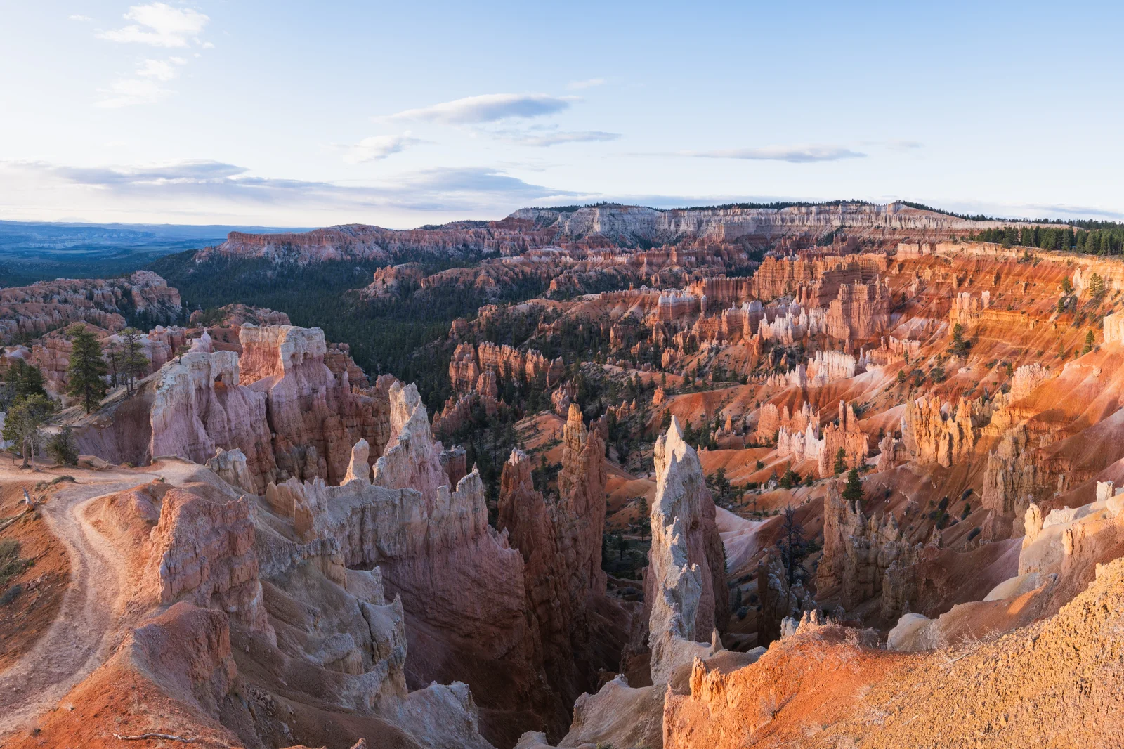
Bryce Amphitheater natural limestone hoodoos viewed from Sunrise Point in Bryce Canyon National Park • Photo: Christian David • License: CC BY-SA 4.0
Editorial Methodology: All facts in this guide are independently corroborated through official public records, municipal licensing files, state agency datasets, and federal land management records. Demographics reflect 2024 U.S. Census Bureau Estimate (Reference Year: 2024; Source: U.S. Census Bureau; Last Checked: October 2026).
Data Citations: State of Utah (Utah.gov), U.S. Census Bureau, Utah Division of Corporations, National Park Service, Bureau of Land Management, U.S. Forest Service, and Garfield County administrative records.