Reference Year: 2024 • Source: U.S. Census Bureau • Last Checked: October 2026 • Submit Correction
San Juan County, Utah
Authoritative civic guide, municipal directory, geographic facts, and information checked business resources across San Juan County.
Executive Geographic & Civic Profile
Monticello (Administrative Seat) / Blanding (Largest Municipality)
14,489
7,820 sq mi
3,700 – 12,721 ft (Mount Peale, La Sal Mountains)
1880
Canyonlands, Four Corners & Southeastern Utah
Geographic Boundaries: Bounded by Grand County (La Sal Mountains, high desert mesas) to the north, Apache and Navajo Counties, Arizona (37th parallel north) to the south, Montezuma, Dolores, San Miguel, and Montrose Counties, Colorado (Four Corners Monument) to the east, and Kane and Garfield Counties (Colorado River and Lake Powell) to the west. Encompasses the entire southeastern corner of Utah, spanning from the alpine peaks of the La Sal and Abajo Mountains across the vast red rock canyonlands of Cedar Mesa, the San Juan River canyon, and the sovereign tribal lands of the Navajo Nation and Ute Mountain Ute Tribe to the Four Corners junction.
According to official census demographic data (2024 U.S. Census Bureau Estimate), San Juan County supports an established resident population of 14,489. Regional planning prioritizes balanced commercial growth, open-space preservation, natural resource stewardship, and active civic infrastructure.
Sovereign Tribal Lands & Jurisdictional Boundaries
In accordance with federal Indian law and sovereign jurisdictional boundaries, tribal reservations located within geographic county perimeters operate under independent tribal authority. San Juan and Juab County governments maintain no administrative, municipal, or licensing jurisdiction over sovereign tribal entities or reservation lands.
The southern region of San Juan County encompasses extensive chapters of the Navajo Nation (Diné Bikéyah), including Halchita/Mexican Hat, Oljato-Monument Valley, Aneth, Red Mesa, and Montezuma Creek. Tribal governance operates under the sovereign authority of the Navajo Nation government headquartered in Window Rock, Arizona. San Juan County coordinates public roads, emergency response, and public school infrastructure, but maintains no regulatory authority over sovereign tribal lands or tribal enterprises.
The White Mesa Community south of Blanding is home to the Ute Mountain Ute Tribe, holding sovereign reservation lands and cultural heritage in San Juan County.
Access to tribal parks, including Monument Valley Navajo Tribal Park, is administered by the Navajo Nation Parks & Recreation Department and requires Navajo Nation entry fees and permits (National Park Service passes are not accepted). Visitors must observe tribal laws, remain on designated public highways, respect residential privacy, and obtain licensed tribal guides for off-highway cultural exploration.
Geography, Elevation & Regional Climate
San Juan County encompasses diverse Western topography ranging across elevations of 3,700 – 12,721 ft (Mount Peale, La Sal Mountains). The regional climate is characteristically semi-arid with four distinct seasons, featuring low relative humidity, abundant sunshine, and cold winters with snow accumulations concentrated across mountain watersheds and high plateaus. Annual precipitation supports native desert shrublands, pinyon-juniper woodlands, sagebrush steppe, and subalpine forests that define the regional geography.
Information Checked Directory in San Juan County
Information Checked Directory & Public Services
Featured commercial enterprises physically operating in San Juan County across core economic sectors, providing checked local services.
San Juan Pharmacy
Shopping & Retail
Full-service independent retail pharmacy on Main Street in Blanding, providing prescription medications, customized compounding, medical supplies, and personal health goods across San Juan County.
Twin Rocks Cafe
Restaurants & Food
Scenic dining room located directly beneath the historic Navajo Twin rock formations in Bluff, serving authentic Navajo fry bread, blue corn waffles, fresh beef burgers, and Southwestern specialties.
Wild Expeditions
Recreation & Outfitting
Licensed professional river running outfitter and backcountry guide service in Bluff offering multi-day whitewater rafting trips down the San Juan River and guided cultural hiking expeditions of Cedar Mesa.
San Juan Hospital
Healthcare & Wellness
25-bed critical access community hospital in Monticello providing 24/7 Level 4 emergency trauma services, diagnostic imaging, surgical care, clinical laboratory services, and outpatient clinics for southeastern Utah.
Search San Juan County Business Directory
Direct access to local contractors, medical clinics, retail establishments, and professional services across San Juan County.
Municipalities & Communities in San Juan County
Explore incorporated municipal governments, civic centers, and regional hubs within San Juan County.
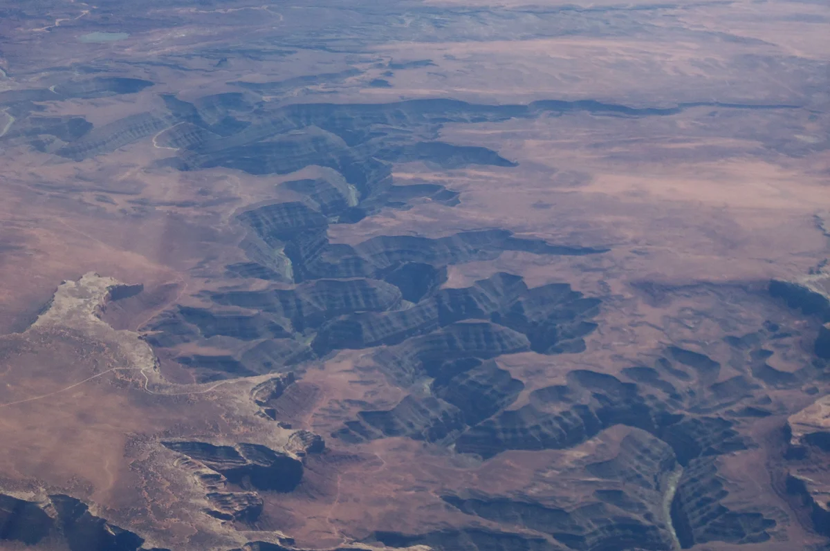
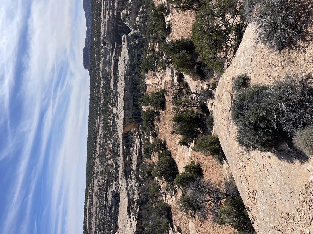
Authentic Landscapes & Historic Architecture
Verified documentary photography showcasing public conservation areas, historic facilities, and scenic viewpoints in San Juan County.
Resident Information & Municipal Services
Verified public administration, emergency management, school districts, and essential public utilities serving San Juan County residents.
County Administration
- San Juan County Commission (Three elected commissioners representing geographic districts)
- San Juan County Assessor’s Office (Property valuation & tax assessments)
- San Juan County Clerk / Auditor (Elections, corporate filings, fiscal oversight)
- San Juan County Recorder’s Office (Land deeds, surveys, mining records)
- San Juan County Treasurer (Tax collection and treasury management)
- San Juan County Attorney’s Office (Civil legal counsel and criminal prosecution)
- San Juan County Building, Zoning & Planning Department
- San Juan Public Health Department (County clinic branches in Monticello and Blanding)
Public Safety & Emergency
- San Juan County Sheriff’s Office (Patrol, investigations, corrections, countywide search and rescue)
- Blanding Police Department (Municipal law enforcement and community policing)
- Navajo Nation Police Department (Crownpoint / Kayenta districts serving Navajo chapters)
- Utah Highway Patrol (Section 14 regional patrol along US-191 and US-491 corridors)
- Monticello Volunteer Fire Department
- Blanding Volunteer Fire Department
- Bluff Volunteer Fire Department
- La Sal Volunteer Fire Department
Healthcare Resources
- San Juan Hospital (Monticello – 25-bed critical access hospital, 24/7 Level 4 Trauma Emergency Room, surgery, laboratory, radiology)
- San Juan Clinic Blanding (Outpatient family medicine, pediatrics, and preventive care)
- Utah Navajo Health System (UNHS – Comprehensive community clinics in Montezuma Creek, Monument Valley, Blanding, and Navajo Mountain providing primary medical, dental, and behavioral health)
Education & Libraries
- San Juan School District (Monticello High School, San Juan High School in Blanding, Whitehorse High School in Montezuma Creek, Monument Valley High School in Oljato; serving approx. 3,000 students)
- Utah State University Blanding (USU Blanding – Comprehensive regional college campus offering technical certificates, associate degrees, bachelor’s degrees, and nursing programs with leading Native American student enrollment)
- San Juan County Library System – Blanding Branch (Regional media center and public computing)
- San Juan County Library System – Monticello Branch (Historic community library and genealogy collection)
- Bluff Community Library
- Montezuma Creek Community Library
- Mexican Hat Community Library
- La Sal Community Library
Transportation Arterials & Public Transit
- U.S. Highway 191 (Primary north-south arterial linking Moab through Monticello and Blanding to Bluff, Mexican Hat, and Arizona)
- U.S. Highway 491 (Major eastern corridor connecting Monticello east to Cortez and Durango, Colorado)
- Utah State Route 95 (Bicentennial Highway connecting Blanding west across Comb Ridge and Natural Bridges to Lake Powell and Hanksville)
- Utah State Route 261 (Connecting UT-95 south down the dramatic Moki Dugway switchbacks to Valley of the Gods and Mexican Hat)
- U.S. Highway 163 (Scenic corridor traversing Mexican Hat and the world-famous Monument Valley red rock buttes to Arizona)
- San Juan County Express / Regional Medical Transit (Coordinated non-emergency transportation for medical appointments)
- Salt Lake Express / Greyhound Connection (Intercity coach connections through Moab and Monticello along US-191)
- Monticello Municipal Airport (U64) & Blanding Municipal Airport (BDG – General aviation, aerial survey, air ambulance emergency transport)
Parks, Public Lands & Outdoor Recreation
Federal conservation lands, state parks, and regional recreation areas throughout San Juan County.
Federal Public Lands (NPS, BLM, USFS)
- Canyonlands National Park – Needles District (NPS – Cedar Mesa sandstone spires, Chesler Park, Elephant Hill backcountry 4WD route)
- Natural Bridges National Monument (NPS – Sipapu, Kachina, and Owachomo natural bridges; designated first International Dark Sky Park)
- Hovenweep National Monument (NPS – Six prehistoric Puebloan villages with stone towers straddling Utah/Colorado border)
- Bears Ears National Monument (Co-managed by BLM, USFS, and Bears Ears Inter-Tribal Coalition representing Hopi, Navajo, Ute Mountain Ute, Ute Indian, and Zuni tribes)
- Manti-La Sal National Forest – Monticello Ranger District (USFS – Abajo Mountains, Blue Mountain campgrounds, Dark Canyon Wilderness)
- BLM Monticello Field Office (Public lands managing Valley of the Gods, Comb Ridge, Indian Creek climbing corridor, Cedar Mesa)
State Parks & Regional Attractions
- Edge of the Cedars State Park Museum in Blanding (State park museum housing the largest collection of Ancestral Puebloan pottery in the Four Corners and a preserved prehistoric kiva)
- Goosenecks State Park near Mexican Hat (Utah State Park overlooking entrenched 1,000-foot meanders of the San Juan River)
- Loyd’s Lake and Monticello City Parks (Local municipal recreation and community walking trails)
- Monument Valley Navajo Tribal Park (Tribal park featuring world-famous sandstone monoliths, Mittens, and John Ford Point)
- Valley of the Gods (17-mile scenic backcountry dirt drive through isolated sandstone towers and mesas)
- Indian Creek Recreation Area (Internationally recognized sandstone crack climbing destination in northern San Juan County)
- Bluff Fort Historic Site (Restored historic pioneer settlement, co-op store, and replica log cabins in Bluff)
Economic Landscape, Industry Sectors & Commercial Permitting
San Juan County maintains an established economic base founded upon diverse commercial, agricultural, and industrial pillars. Commercial development operates under coordinated municipal-county guidelines: businesses within incorporated municipalities obtain commercial business licenses through their municipal clerk, while enterprises in unincorporated county areas are permitted directly through the San Juan County administrative offices.
- Public Land Administration & Tourism (National Park Service, USFS, BLM, tribal park visitation, hospitality)
- Higher Education & Public Sector (Utah State University Blanding, San Juan School District, county and state government)
- Healthcare & Tribal Health Services (San Juan Hospital, Utah Navajo Health System)
- Agriculture & Livestock Grazing (Dryland wheat, pinto beans, beef cattle rangeland in Monticello and La Sal)
- Energy & Natural Resources (Oil and natural gas extraction in Aneth field, uranium and vanadium processing at White Mesa Mill)
All legal commercial entities operating in Utah must register their organizational charter with the Utah Division of Corporations and Commercial Code and maintain appropriate sales tax accounts with the Utah State Tax Commission. Consumers are encouraged to verify professional contractor, medical, and trade licensing directly through the Utah Division of Professional Licensing (dopl.utah.gov).
Annual Civic Events & Cultural Traditions
Signature annual festivals, county fairs, rodeos, and community celebrations held across San Juan County.
- San Juan County Fair and Junior Livestock Show (August celebration in Monticello since 1940s)
- Blanding 4th of July Celebration (Community parade, 5K run, concerts, and evening fireworks)
- Utah State University Blanding Indigenous Peoples Day Pow Wow (Autumn Native American cultural celebration)
- Bluff International Balloon Festival (January hot air balloon launches over sandstone bluffs)
- San Juan Sweetheart 5K and Monticello Winter Trails Festival
Regional Guides & Utah Travel Resources
Deepen your exploration of San Juan County with regional itineraries, moving guides, and scenic driving routes.
Explore community profiles, civic directories, and local business ecosystems across Utah.
Statewide travel itineraries, public lands access, national monuments, and regional highways.
How local businesses can claim profiles and establish claimed profile status on Greater Utah.
Adjacent Counties & Regional Travel
Explore neighboring counties connected across Utah:
Promote Your San Juan County Enterprise
Connect with residents, commercial buyers, and traveling visitors actively seeking trusted local services and products in San Juan County.
📷 Image Provenance & Photography Attribution
✓ Real Location Verified
GreaterUtah strictly enforces an Image Authenticity & Media Provenance Policy. All documentary imagery depicts authentic Utah locations and is verified via staff photography, federal public-domain repositories, or verified Creative Commons records. AI-generated, synthetic, and deceptive imagery are strictly prohibited.
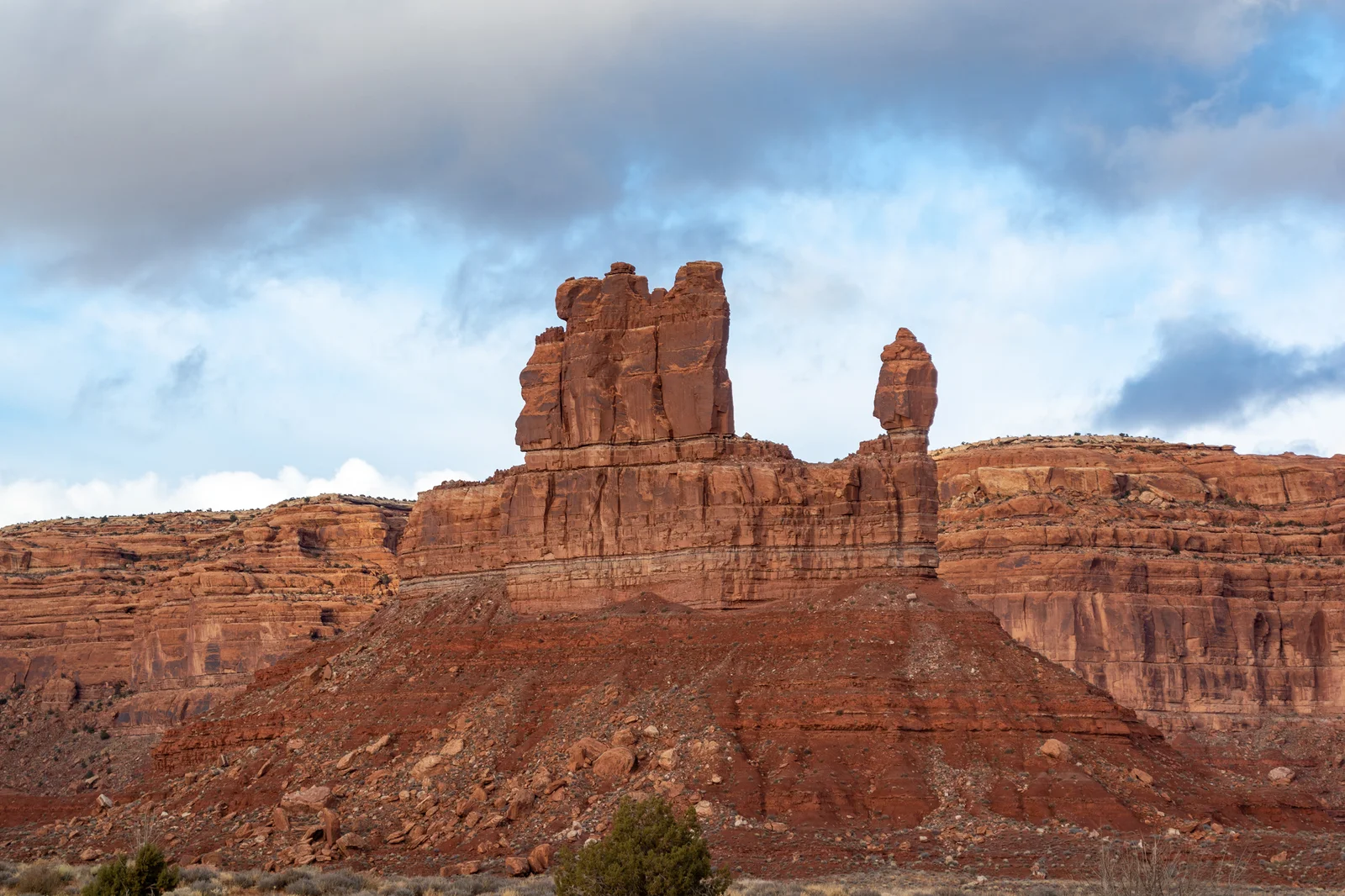
Valley of the Gods sandstone mesas and isolated red rock buttes in San Juan County • Photo: RuggyBearLA • License: CC BY 2.0
Editorial Methodology: All facts in this guide are independently corroborated through official public records, municipal licensing files, state agency datasets, and federal land management records. Demographics reflect 2024 U.S. Census Bureau Estimate (Reference Year: 2024; Source: U.S. Census Bureau; Last Checked: October 2026).
Data Citations: State of Utah (Utah.gov), U.S. Census Bureau, Utah Division of Corporations, National Park Service, Bureau of Land Management, U.S. Forest Service, and San Juan County administrative records.