Reference Year: 2024 • Source: U.S. Census Bureau • Last Checked: October 2026 • Submit Correction
Sanpete County, Utah
Authoritative civic guide, municipal directory, geographic facts, and information checked business resources across Sanpete County.

Executive Geographic & Civic Profile
Manti
30,376
1,590 sq mi
5,200 – 10,900+ ft (South Tent Mountain)
1852
Central Utah & Sanpete Valley (‘Utah’s Little Denmark’)
Geographic Boundaries: Bounded by Utah County to the north, Sevier County to the south, Carbon County and Emery County (Wasatch Plateau crest) to the east, and Juab County (San Pitch Mountains) to the west. Occupies the picturesque, historic Sanpete Valley enclosed between the steep Wasatch Plateau (home to Skyline Drive) on the east and the San Pitch Mountains on the west, drained southward by the San Pitch River toward the Sevier River basin.
According to official census demographic data (2024 U.S. Census Bureau Estimate), Sanpete County supports an established resident population of 30,376. Regional planning prioritizes balanced commercial growth, open-space preservation, water resource protection, and active transportation connectivity.
Geography, Elevation & Regional Climate
Sanpete County encompasses diverse Western topography ranging across elevations of 5,200 – 10,900+ ft (South Tent Mountain). The regional climate is characteristically semi-arid with four distinct seasons, featuring low relative humidity, warm sunny summers, and cold winters with snow accumulations concentrated across mountain watersheds. Annual precipitation supports native high-desert shrublands, sagebrush valleys, and alpine forest ecosystems that define the region’s scenic character.
Information Checked Directory in Sanpete County
Information Checked Directory & Public Services
Featured commercial enterprises physically operating in Sanpete County across core economic sectors, providing checked local services.
Sanpete Valley Hospital
Healthcare & Medical
Intermountain Health 18-bed critical access hospital and Level 4 trauma center in Mount Pleasant providing emergency care, general surgery, maternity, and diagnostic imaging.
Gunnison Valley Hospital
Healthcare & Medical
Independent acute care hospital in Gunnison delivering comprehensive surgery, emergency care, regional cancer chemotherapy infusion, orthopedics, and maternity services.
Horseshoe Mountain Hardware
Home Services & Hardware
Hardware, agricultural supply, and lumber center in North Sanpete providing contractor building materials, plumbing fittings, electrical gear, ranch fencing, and power tools.
The Malt Shop
Restaurants & Food
Classic hamburger diner and ice cream shop across from Snow College in Ephraim serving thick malts, fresh Angus burgers, crinkle fries, and onion rings.
Search Sanpete County Business Directory
Direct access to local contractors, medical clinics, retail establishments, and professional services across Sanpete County.
Municipalities & Communities in Sanpete County
Explore incorporated municipal governments, civic centers, and regional hubs within Sanpete County.
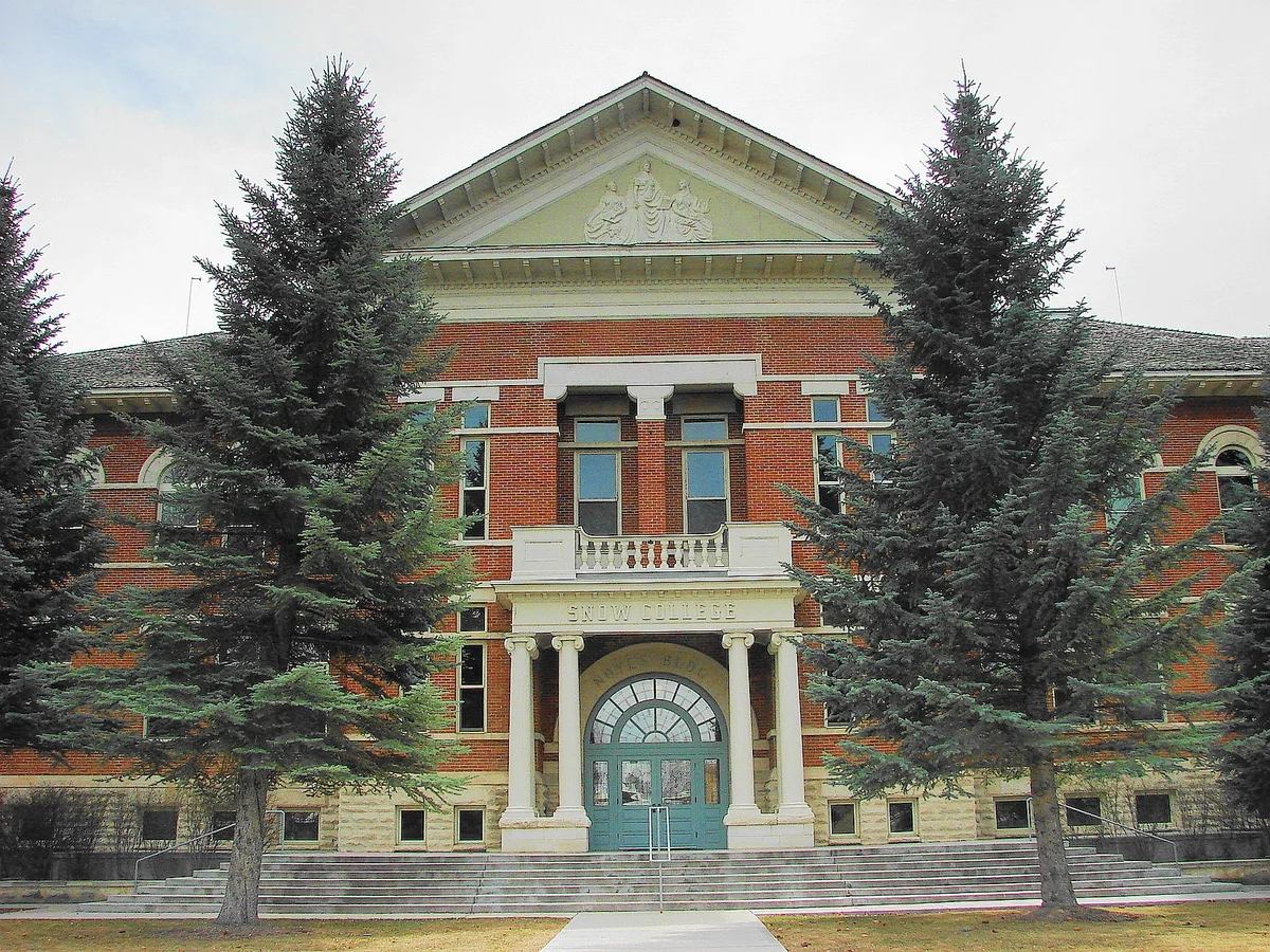
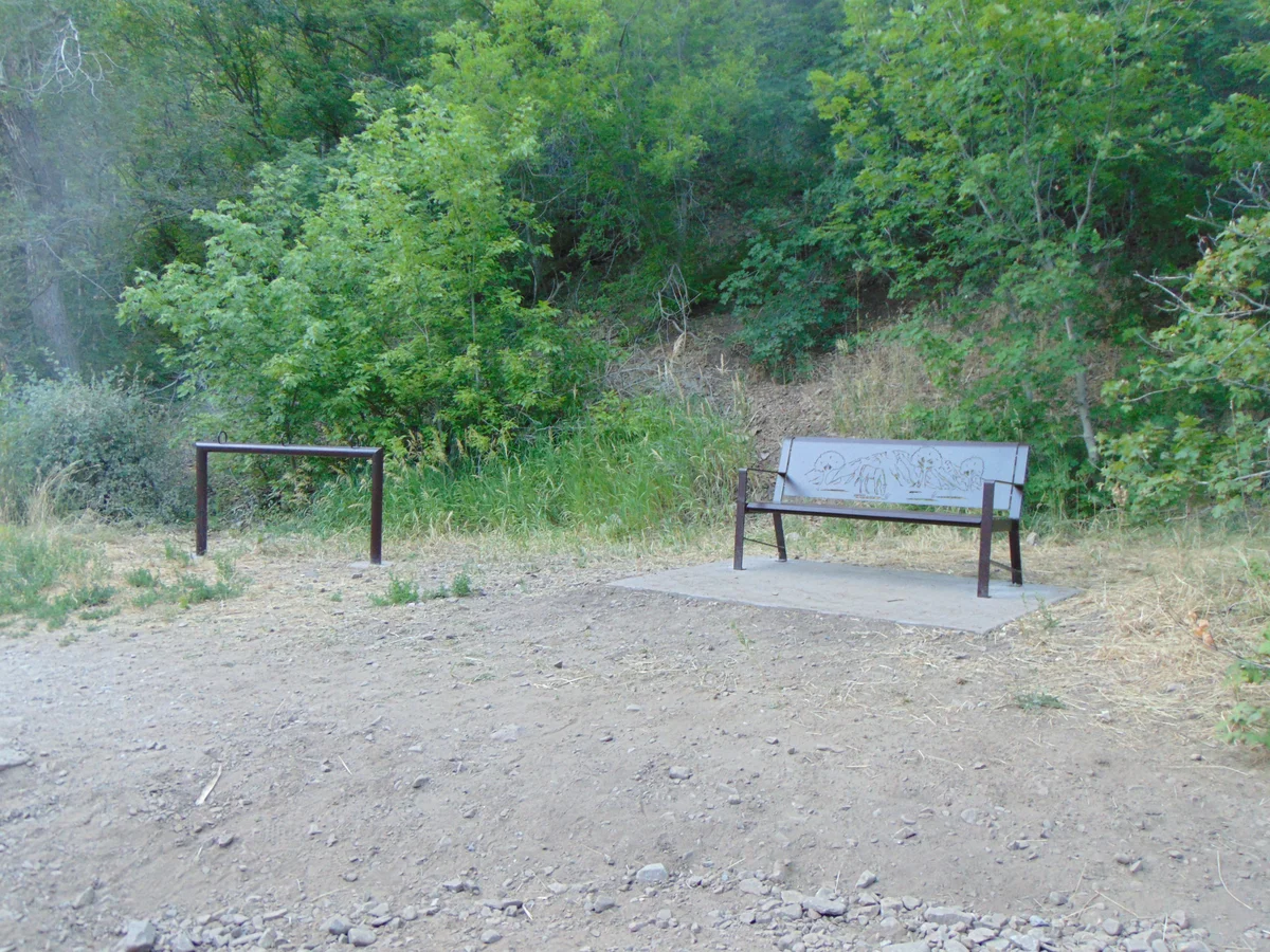
Authentic Landscapes & Historic Architecture
Verified documentary photography showcasing public conservation areas, historic facilities, and scenic viewpoints in Sanpete County.
Resident Information & Municipal Services
Verified public administration, emergency management, school districts, and essential public utilities serving Sanpete County.
County Administration
- Sanpete County Commission (Three elected commissioners administering legislative and executive duties)
- Sanpete County Assessor’s Office (Property valuation, agricultural exemptions, and tax mapping)
- Sanpete County Clerk’s Office (Elections, licensing, and commission records)
- Sanpete County Auditor’s Office (County financial management and budget oversight)
- Sanpete County Recorder’s Office (Real estate records, pioneer plats, deeds, and easements)
- Sanpete County Treasurer’s Office (Tax billing, collection, and public investments)
- Sanpete County Attorney’s Office (Legal advisory and prosecution)
- Central Utah Public Health Department (Sanpete County branches in Manti and Mount Pleasant)
- Sanpete County Building and Zoning Department
Public Safety & Emergency
- Sanpete County Sheriff’s Office (Manti — County patrol, adult correctional facility, dispatch, search and rescue)
- Ephraim City Police Department
- Mount Pleasant Police Department
- Gunnison Valley Police Department
- Fairview Police Department
- Sanpete County Fire Warden & Volunteer Fire Departments (Manti, Ephraim, Mt. Pleasant, Gunnison, Fairview, Moroni, Spring City, Fountain Green)
- Sanpete County Ambulance Service
Healthcare Resources
- Sanpete Valley Hospital (Intermountain Health in Mount Pleasant — 18-bed critical access hospital, Level 4 Trauma Center, 24/7 ER, general surgery, maternity, wound care)
- Gunnison Valley Hospital (Independent non-profit acute care hospital in Gunnison, oncology infusion clinic, orthopedics, surgical services, 24/7 ER)
- Ephraim Clinic and Manti Family Clinic
- Central Utah Mental Health Clinic
Education & Libraries
- North Sanpete School District (North Sanpete High in Mount Pleasant, middle and elementary schools, approx. 2,600 students)
- South Sanpete School District (Manti High School, Gunnison Valley High School, approx. 3,300 students)
- Wasatch Academy (Mount Pleasant — Historic independent international college preparatory boarding school founded in 1875)
- Snow College (Ephraim — Leading residential two-year state college founded in 1888, consistently ranked among the top community colleges in the nation for student success, Badger athletics, performing arts, and four-year commercial music/software engineering degrees)
- Ephraim Public Library (Community library near Snow College campus)
- Manti Public Library (Historic Carnegie public library)
- Mount Pleasant Public Library (Historic Carnegie library on Main Street)
- Gunnison City Library
- Spring City Old School Community Library
Transportation Arterials & Public Transit
- US Highway 89 (The Heritage Highway — Main spine traveling north-south through Fairview, Mt. Pleasant, Spring City, Ephraim, Manti, and Gunnison)
- Utah State Route 132 (Connecting Nephi on I-15 through Fountain Green and Moroni to Ephraim)
- Utah State Route 28 (Connecting Gunnison northwest through Levan to I-15 at Nephi)
- Utah State Route 31 (Huntington & Eccles Canyons National Scenic Byway — Climbing from Fairview over the Wasatch Plateau to Huntington)
- Skyline Drive (Rugged seasonal backcountry road traversing the crest of the Wasatch Plateau at 10,000+ ft)
- Manti-Ephraim Airport (41U — Municipal and corporate general aviation, aerial application)
- Central Utah Transit / Area Agency on Aging (Demand-response senior and medical transit)
- Salt Lake Express (Intercity scheduled coach service connecting along US-89 to Provo and Salt Lake City)
Parks, Public Lands & Outdoor Recreation
National forests, state parks, and protected recreational watersheds throughout Sanpete County.
Federal & State Conservation Lands
- Manti-La Sal National Forest (Sanpete Ranger District — Skyline Drive, high alpine reservoirs, hunting, snowmobiling, Arapeen OHV Trail System)
- Maple Canyon (Near Moroni and Freedom — World-famous cobblestone conglomerate rock climbing canyon with over 550 bolted routes, box canyon hiking)
- Yuba State Park (Reservoir recreation and sandy beaches extending into western Sanpete County)
- BLM Richfield Field Office (Public rangeland and foothill trails)
Regional Parks & Signature Attractions
- Palisade State Park (Sterling — Beautiful mountain lake resort offering an 18-hole championship golf course, paddleboarding, fishing, swimming, camping, and OHV trail access)
- Fairview Museum of History and Art (Exhibiting the complete fossil skeleton of the Fairview Columbian Mammoth and extensive pioneer art)
- Manti City Park and Sports Complex
- Ephraim Pioneer Park and Canyon Road Recreation Area
- Historic Manti Utah Temple (Magnificent oolitic limestone pioneer temple completed in 1888 on Temple Hill overlooking the valley)
- Historic Spring City (The entire town is listed on the National Register of Historic Places, distinguished for restored 19th-century stone homes and artist studios)
- Snow College Noyes Building and Campus Heritage Square in Ephraim
- Arapeen OHV Trail System (600 miles of interconnected mountain trails across the Wasatch Plateau)
Economic Landscape, Industry Sectors & Commercial Permitting
Sanpete County maintains an established economic base founded upon diverse commercial and industrial pillars. Enterprise development operates under municipal-county coordination: enterprises within incorporated city boundaries obtain local commercial licenses through their municipal clerk, while businesses in unincorporated areas are licensed directly through the Sanpete County administrative division.
- Higher Education & Institutional Academics (Snow College is a leading economic driver and employer in central Utah)
- Agriculture, Dairy & Poultry (Turkey production heritage, dairy cattle, high-protein alfalfa hay, sheep and beef ranching)
- Public Sector, Corrections & Governance (Central Utah Correctional Facility in Gunnison, public school districts, county administration)
- Healthcare & Hospital Systems (Sanpete Valley Hospital and Gunnison Valley Hospital)
- Artisan Economy, Fine Arts & Historic Tourism (Spring City galleries, antique restoration, stone quarrying and masonry)
- Outdoor Recreation & Motorsports (Arapeen OHV trail tourism, rock climbing in Maple Canyon, golfing at Palisade)
All legal commercial entities operating in Utah must register their organizational charter with the Utah Division of Corporations and Commercial Code and maintain appropriate sales tax accounts with the Utah State Tax Commission. Consumers are encouraged to verify professional contractor, medical, and trade licensing directly through the Utah Division of Professional Licensing (dopl.utah.gov).
Annual Civic Events & Cultural Traditions
Signature annual festivals, agricultural exhibitions, and community celebrations held across Sanpete County.
- Scandinavian Heritage Festival (Memorial Day weekend in Ephraim — Celebrating the Danish, Swedish, and Norwegian heritage with crafts, smorgasbord, Viking encampments, and grand parade)
- Sanpete County Fair (August at the Manti Fairgrounds with demolition derby, PRCA rodeo, carnival, and livestock auction)
- Fountain Green Lamb Days (Mid-July tradition celebrated with a famed pit-barbecued lamb feast, parade, and games)
- Spring City Heritage Day & Studio Tour (Late May historic home tours and September art studio openings)
- Mount Pleasant Pioneer Days (Fourth of July week celebration and rodeo)
- Gunnison Valley 4th of July Celebration
Regional Guides & Utah Travel Resources
Deepen your exploration of Sanpete County with regional itineraries, moving guides, and scenic driving routes.
Explore community profiles, civic directories, and local business ecosystems across Utah.
Statewide travel itineraries, public lands access, national monuments, and regional highways.
How local businesses can claim profiles and establish claimed profile status on Greater Utah.
Adjacent Counties & Regional Travel
Explore neighboring counties connected across Utah:
Promote Your Sanpete County Enterprise
Connect with residents, local commercial buyers, and traveling visitors actively seeking trusted local services and products in Sanpete County.
Editorial Methodology: All facts in this guide are independently corroborated through official public records, municipal licensing files, and state datasets. Demographics reflect 2024 U.S. Census Bureau Estimate (Reference Year: 2024; Source: U.S. Census Bureau; Last Checked: October 2026).
Data Citations: State of Utah (Utah.gov), U.S. Census Bureau, Utah Division of Corporations, and local municipal administrative records.